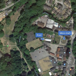
The City of Nottingham is planning to become the first net zero council in the UK. To achieve this the City Council is looking to employ all forms of renewable energy available to them. Amongst a wide selection of options, minewater heat and heat networks stands out. We support the council in considering this option for use in Bulwell.
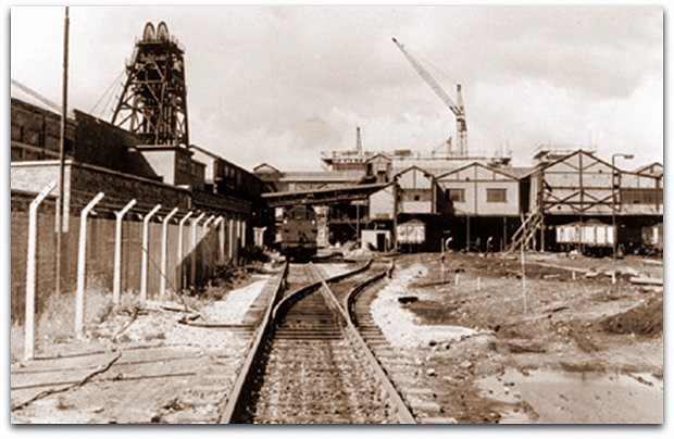
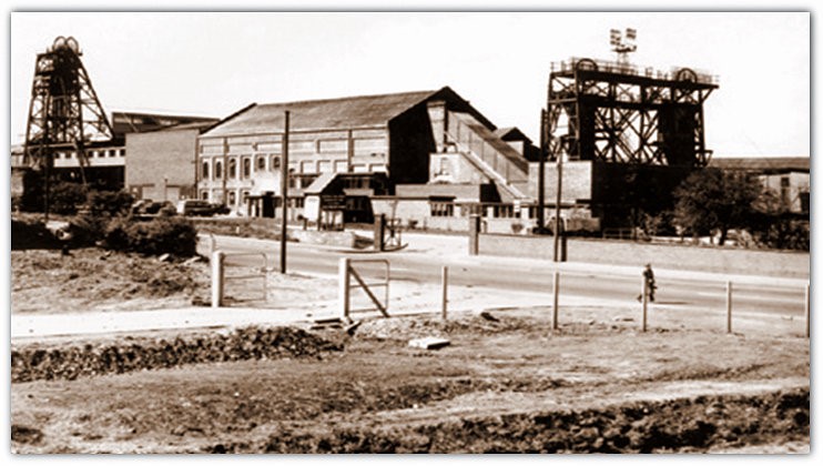
This area once was the centre of coal winning in the Nottingham area. The mine was known as Babbington Colliery or Cinderhill.
Bulwell is amongst the most stressed communities in the UK, many residents suffer from fuel poverty and the opportunity to bring new low cost heat to the area can not come too soon.
The piece below gleaned from the internet gives one a flavour of mining and its importance to the area.
Babbington (Cinderhill) Closed After 142 Years
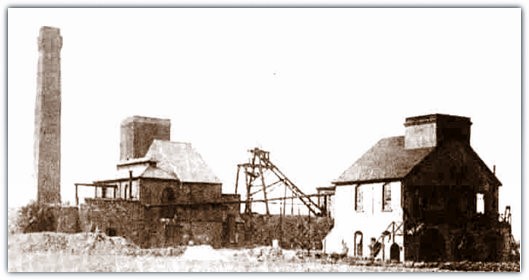
Babbington (Cinderhill) colliery (Nottinghamshire) sunk south of Bulwell as Cinderhill in 1842-1843 by Thomas North, when he was 37 years old.
It was closed Jan 1986 after 142 years and merged with Hucknall that was sunk in 1866.
The Babbington Coal Co was floated prior to 1840 and named after the small hamlet of Babbington where Thomas North and partner were working small pits.
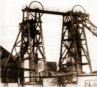
High Holborn and Turkey Field pits at 130 yards (119m) and 140 yards (128m) deep were working the Deep Soft and Deep Hard in the vicinity. Both shafts at the new Cinderhill colliery, later renamed Babbington were 7 feet (2.1m) dia and named Windy and Smokey and were 215 feet (65.5m) above Ordnance datum, (the furnace ventilation ceased in 1899). The pit was nicknamed Babbo.
The winding engine made by Davis of Tipton, Staffs, 180hp and shaft capacity estimated at 600 tons per 12 hour shift. A new engine made by Thornewill and Wareham 150 hp was installed in 1853. There was one cage in each shaft, with wooden guides and one tub/tram. Pulleys were 12 feet (3.65m) dia. 2 large brick chimneys for the boiler plant for steam raising.
The Furnace drift was known as Cupola.
No3 shaft sunk in 1851 was called Hempshill as UC for North and North East Top Hard workings. A brick cupola and horse gin on surface. The return air from Bulwell drift and topside workings passed over the 9 feet (2.74m) wide furnace and 3 boiler fires.
The pit bottom was made secure by a barrel arch with travelling road all around.
No4 shaft 10 feet (3.05m) dia was sunk 1864. 500 tons of Top Hard coal per day was turned at this shaft up to 1914, the steam winding engine was made by Davis and Co in 1854, and had 4½” flat iron wire ropes, 12 feet (3.65m) dia pulleys and a 35 seconds run. 8 plain egg ended boilers for steam raising. 2 cages with wooden guides with 3 trams in each cage, and wooden brattice between each cage throughout the shaft and the shaft was finally abandoned in 1929 when the coal pillar supporting the shaft was robbed then from 1929-1933.
Seams worked: Cinderhill Main,
- Top Hard at 218 yards (199m) 1843-1916 then worked pillars 1930-1935 (Top Hard, Coombes and Floor seam -12/2/1954 when abandoned)
- Dunsil 3’ 3” (1.0m) 1919-25/3/1923
- First Waterloo 1928
- First Waterloo, Second Waterloo and Third Waterloo all abandoned 12/2/1954
- Main Bright 18/10/1952
- Low Bright abandoned 24/7/1958, Nuthall Main or High Hazel (Cinderhill) 15/1/1929 and 9/11/1955
- Low Hazel 1928-1929
- Deep Soft at 307 yards (280m) 1859– 1911/1922, including workings from Broxtowe and Hempshill (photo) finished 6/1/1971
- Low Bright 24/7/1958
- Deep Hard 2’ 10” (0.86m) at 420 yards (384m) –19/9/1975
- Piper abandoned 30/11/1985
- Tupton abandoned 30/11/1985
- Three Quarter abandoned 30/11/1985
- Blackshale (inc Hucknall) –Sep 1986. As can be seen over 12 seams were worked at the pit, a number not exceeded anywhere else.
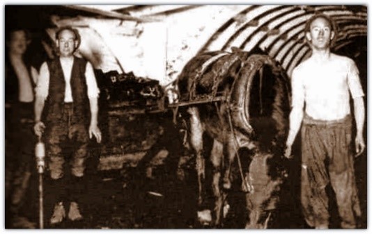
Stables were in the pit bottom area. In 1856 only donkeys were in use as the roadways were too low to allow ponies to work. It was also noted by WW Fyfe on his visit underground that although methane gas was hissing from the coal at the face naked lights (green candles) were quite safe because of the good ventilation flow.
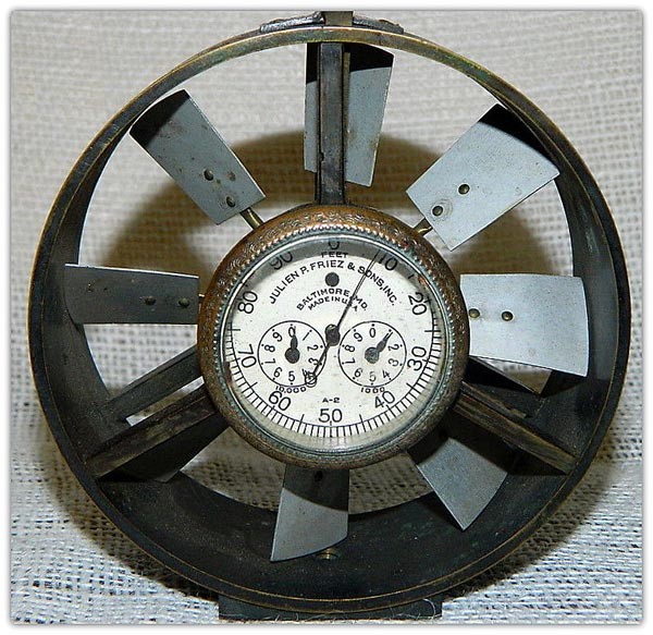
The Biram anemometer was in use and readings of 40,000 to 50,000 cu ft of air per minute were passing on the main roads but the air had to travel over 4,100 yards (3,750m).
On the surface 18 miles of railway was in operation worked by 21 fixed and locomotive steam engines, partly by horses and partly by gravity.
He also stated that the small Babbington pits had a ready sale of ironstone for use at Stanton ironworks.
There was a 120hp Watt beam engine for pumping and a 40hp high pressure winding engine. There was also a pumping engine at Turkey Field.
There was an underground fire in an engine house in the pit bottom on Thursday 9/4/1857.
There were 2 engines for drawing coal in tubs from the extreme ends of the pit.
Heat from the boiler flue of one of the engines set fire to the bed of coal some 45 ft (app 14m) in extent and 6 ft (1.83m) deep. All efforts to put out the fire failed and at 2pm on that day 2 engines from the fire brigade under the supervision of Mr Fox descended the shaft and on Tuesday evening 14/4/1857 at 7pm the fire was out. No material damage was done but considerable outlay was necessary to render the place secure again.
1986 –
Babbington (Cinderhill) Closed After 142 Years
– Continued –
No4 shaft at 420 yards (384m) deep was 6 yards (5.5m) diameter.
No5 shaft at 11 feet (3.35m) dia was sunk 125 yards (114m) to Low Bright in 1901, but used as an Air shaft and deepened in 1944.
BA Collieries Co Ltd took over the pits in 1936 and in 1942 No6 shaft Cinderhill at 18’ 2” (5.54m) dia was sunk 140 yards (128m) to Main Bright.
The No5 Bulwell shaft 10 feet (3.05m) dia, 307 yards (280m) deep, some 2 miles from Cinderhill, sunk in 1868 to the Top Hard to assist ventilation and also to allow men living nearby to descend to their work more easily was exhausted by 1910.
A small amount of coal, 100 to 150 tons a day was drawn by a small engine 25hp vertical high pressure, steam supplied by 2 egg ended boilers 4’ 6”(1.37m) x 30 feet (9m) long, to supply Landsale for Bulwell village and neighbourhood.
The Main Bright was worked until 1944.
From Jan 1945 to Oct 1946, No4 shaft was enlarged from 10 feet (3.05m) dia to 18’ 2” (5.54m) and deepened from 172 yards (157m) to Deep Soft at 202 yards (185m). The surface was 193 ft (58.8m) above sea level and the shaft finally abandoned in 1929 when the coal pillar supporting the shaft was then robbed 1929-1933.
The Cinderhill Main seam 3’ 9” (1.14m) was at 522 ft (159m) and Top Hard at 659’ 9” (201m).
In 1954 No1 Hucknall Colliery No2 shaft (sunk in 1870) was deepened from the Top Hard seam horizon at 143 yards (130m) to 553 yards (505m) and called No7 shaft for ventilation for Babbington.
In 1956/57 there was a major reorganisation when the original wooden headgears at Windy and Smokey shafts were demolished and new modern steel headgears built. During this period some men were bussed from Babbington pithead baths to Hucknall Top pit where the men rode No7 shaft to access the Deep Soft districts that were approaching Hucknall No2 pit shaft pillar in the town, substantially some distance from Babbington shafts. The men were bussed back to Babbington for bathing at the end of their shift. This system continued until the Babbington No1 and No2 shafts were brought back into commission as upcast shafts.
In 1967 No6 shaft was abandoned, filled in and capped.
The Newcastle shafts, sunk to Top Hard at 136 yards (124m) in 1853, were at Bobber’s Mill. Top Hard worked 1853-1928, Low Hazel from Bagthorpe heads 1916-1928, Main Bright 4’ 0” (1.22m) 40 yards (37m) High Hazel 2’ 9” (0.84m) 1928-1929 and Threequarter 85 yards (78m) deep, 100hp engine.
Kimberley shafts sunk 1855 to Top Hard, worked 1855-1875.
An UC shaft 9 feet (2.74m) dia, 110 yards (100m) deep with 6 yards (5m) sump, shaft bratticed throughout, single tram cages. A DC and pumping shaft 7 feet (2.1m) dia 110 yards (100m) deep plus 10 yards (9m) sump. 2 more shafts sunk to Deep Soft and worked 1865-1897, and Deep Hard 1864-1876. Broxtowe, 2 x 7 feet (2.13m) dia shafts sunk in 1863/65 were connected to the Broxtowe heads.
Under a lease of Strelley royalty held by John Thomas Edge.
Top Hard worked 1893-1917, Deep Soft 1890-1919, Deep Hard 1910-1929. It was merged with Babbington, and used as a ventilation shaft until abandoned and filled 1948/49.
Nuthall Temple pit – an old pit 7 feet (2.1m) dia, app 100 yards (91m) to Top Hard. This was intended by Mr Woodhouse to be a pumping shaft to drain the area and liberate coal to the rise to be worked by Cinderhill, Newcastle and Broxtowe collieries. A large engine house was being constructed, until the owner died. The engine was a vertical beam type.
A 6 feet (1.8m) dia shaft was abandoned at 12 yards (10m) deep.
Babbington 2 shafts 275 yards (250m) sunk 1859, DC 12 feet (3.65m) dia, 2 tiers of 2 trams on each deck, 90hp engine. 6 plain egg ended boilers, UC ventilation only, 10 feet (3.05m) dia, Jack engine 15hp. No haulages underground, all coal loaded out by horses.
On North’s death it was found that he owed Wright’s bank £190,574. The Wrights who traded as the Babbington Coal Co sold the property to Sir Charles Seely and Charles Seely Junior of Birchwood in 1872. The Seelys paid £114,000 for Basford Hall and grounds and the Babbington colliery together with Wright’s interest in the Radford Glebe lease on 3rd July 1872.
Hempshill shaft 43/5244/644476 was capped firstly in 1945 and again in 1955.
Broxtowe shaft E452354 N342932, was filled in 1946 prior to being over tipped. Shaft positions:
- No1 43/5453/319668
- No2 43/5343/313659,
- No3 43/5343/342671
- No4 43/5343/204711
- Cinderhill No6 43/5344/310221
At one time, 6 huge brick built chimneys and 4 wooden headstocks dominated the skyline.
American mining was introduced here under the Lease-lend agreement.
Longwall cutters with 13 feet (4m) jibs and Joy loaders, Duckbill loaders were tried.
It was a unit of No6 Area of the NCB, then South Nottinghamshire Area from 1967-1986.
According to Fred Paling ARICS (later Area Surveyor Yorkshire) when he was at Cinderhill No6 which was less than 200 yards (180m) from the main railway line, everyone knew what time it was in the Hazel seam which was about 120 yards (110m) deep when the 10.30am train was easily heard as it clattered by.
1986 –
Babbington (Cinderhill) Closed After 142 Years
– Continued –
A Sherwen feeder was installed in 1960 and a new stockyard operational also in 1960.
The old Newcastle coal wharf was abandoned in 1962.
A new coal prep plant was opened in 1963.
A Disc shearer with Walton chocks and Groetschel bars with Dobson hydraulic props began production in 1963.
In 1964 on the surface there was a diesel shunting engine named Jayne.
A 200hp Wild haulage engine was installed in 1965.
An experimental movable shotfiring cabin on wheels was in use by 1972.
A Waffler cutter was installed in 1973.
By 1976 there was a standby fan at No7 shaft.
A surface drift started in the pit yard dipping at 1in3 was stopped before reaching any seam but an abandoned plan was never sent in. It only came to light when I was checking over information when work was being done following abandonment of the mine. A footbridge over the lines was built in 1984.
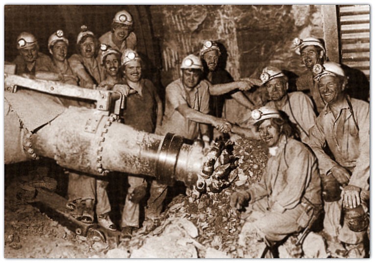
Successful Thirling As Men From Babbington Met Men From Hucknall
Babbington was connected to Hucknall in 1985 and the 2 collieries merged and coal from the Babbington workings was transported through the connection road and raised at Hucknall and included in Hucknall output. The photo shows the successful thirling as men from Babbington met men from Hucknall.
Water collected at Babbington after being pumped to the surface at around 600 gallons per minute from other neighbouring collieries was then allowed to flow through to Moorgreen and into Bentinck via the borehole connection as described in Bentinck résumé.
Maximum output was 881,134 tons in 1967/68 with 1,423 men and maximum manpower was 1,829 in 1955.
This paper was presented by the author at the annual general meeting of The North of England Institute of Mining Engineers. This was held in July 1861 in Birmingham. The author was the Mines Inspector for the Midlands Region (Derbyshire, Leicestershire and Nottinghamshire). There are references in the text to diagrams and maps, these were not available for scanning.
The
Winning And Working
Of
Cinderhill Colliery, Near Nottingham.
By C. F. Stuart Smith, Derby
The meeting of the members of an Institute exclusively devoted to mining and its collateral branches, in the Midland Capital of the Coal and Iron Trades, appearing a no ordinary opportunity for bringing under notice the state of development which coal mining has attained in the Midland district, the writer trusts that the following sketch of the winning and working of the Top Hard seam at the Cinderhill and Babbington Collieries may not prove uninteresting.
The intention is to give a succinct account of this undertaking from its earliest commencement; pointing out, in proceeding, the various stages in the development of its resources, and such peculiarities, both physical and scientific, as may be deemed worth notice.
The works comprised in the Cinderhill and Babbington Collieries will be briefly glanced at; then their physical and geological position, especially that of Cinderhill; thirdly, the system there adopted, and the extent of the works at various stages in their development; and, lastly, the economy of the works from the commencement to the present time.
The Babbington and Cinderhill Collieries are now the property of Thomas North, Esq., and consist of five distinct winnings, three of which are in full working operation, and the other two will also be before the ensuing winter.
The seams worked are, taking Cinderhill as the point of section, the Top Hard, 222 Yards Deep, 5 feet 2 inches thick, used for house and steam purposes; the Deep Soft, 382 Yards Deep, 3 feet 1 inch thick, a bright, swift burning house coal; and the Deep Hard, 398 yards, 3 feet 3 inches thick, a strong steam coal.
The collieries are named, first, the Cinderhill No. 4, or Nuthall Pit, (vide map II.), 222 Yards Deep, working the Top Hard seam, an account of which will form the chief subject of this paper; secondly, the Newcastle Pits, 136 Yards Deep, also working the Top Hard seam; thirdly, the Top Hard at Kimberley, 125 Yards Deep, the headings for working which are now being driven; fourthly, the Babbington No. 2, or Kimberley Pit, 273 Yards Deep, working the deep-hard and Deep Soft seams and, fifthly, the Cinderhill, Nos. 1 and 2, or deep pits, 480 Yards, where the workings in the Deep Soft seam are in the course of being opened. In addition to these, another winning, to be called the Broxtow Colliery, and which is to work the Deep Hard and soft seams, is already sunk to some depth, and arrangements are made for setting on almost directly other foundations. There are also large ironstone mines at Babbington, belonging to Mr. North, but worked by the Stanton Iron Company.
The whole of these works are in the south-west corner of Nottinghamshire, and are situated in the immediate vicinity of the town of Nottingham, the Newcastle Pits being within two miles, the Cinderhill within three miles, and the Kimberley, or Babbington, within five miles of that town.
The present outlets for the disposal of the coal are (vide map II.), on the east, by the Nottingham and Mansfield Branch of the Midland Railway, which brings these collieries nearest of any in Nottinghamshire or Derbyshire to the Great Northern Railway system, via Grantham, for the shipping ports of Grimsby and Boston, and also for the home trade in that district. The Nottingham Canal, which is in connexion with the Trent Navigation, also forms an outlet on this side and on the west the communication is by the Erewash Valley Branch of the Midland Railway, connecting the collieries with the Eastern Counties and London and North-Western Railway systems, and also by the Erewash Canal, which is tributary to the Grand Junction and other Canals. The principal vend is, however, by landsale for the supply of the town and neighbourhood of Nottingham, both with house and steam coal, which, in addition to being sold at the various pit mouths, is, for the convenience of the traders, conveyed by private railway to six different wharfs, situated at the most convenient outlets (vide map II.), over a district eight miles in extent, reaching from the Radford Wharf, within one mile of the very centre of Nottingham, to Ilkeston, in Derbyshire. The railways are worked by locomotive and stationary engine power.
The whole of these collieries which are now being worked are situated (vide map II.) on the magnesian limestone and lower new red sandstone, or Permian formation and Cinderhill, the most eastwardly of them, was the one first sunk. Its geological position will be more clearly understood by reference to map II., where will be seen, on the right hand side, coloured various shades of red, a tract of light red sandstones and drift gravel, stretching east and spreading over a wide district, the boulders in which are supposed to have been washed from the granitic rocks of Norway and deposited here. Next to this lies the magnesian limestone (vide map II.), coloured buff, extending over a considerable area, and resting on the lower new red sandstone, coloured purple, a narrow belt of which, of nearly uniform width, is seen cropping out along the greater portion of its western margin, and lying immediately upon the coal measures, coloured grey, which extend thence several miles to the west.
Whether the lower new red and magnesian limestone lie conformably to the coal measures is very doubtful. In fact, it is generally supposed that they do not The coal measures mostly have a uniform dip towards the east.
On the south and south-east side (vide map II.) a large fault abruptly terminates the coal-field against the new red measures, while to the north it stretches uninterruptedly beyond Leeds. It was then, on the east side of this coal-field, and within four miles of its southern extremity, and within three miles of where the red ground had been worked up to on the south-east, but considerably in the dip of all workings in the neighbourhood, that, in 1840, the then proprietors of the Babbington old collieries determined to try and win the Top Hard seam.
The magnesian limestone had not at this time been sunk through in this district, or such a thin crust had been met with as not to have been noticed, and there was an opinion prevalent that the coal measures terminated abruptly against the new red formation on the east, as on the south and south-east (vide map II.).
Some forty years previous the estate had been reported on by the most eminent viewer in the district, and pronounced to contain no coal, and this was still the general belief, so much so, that only a few years previously a large portion of the adjoining estate had been sold for a comparatively small amount. The proprietors, however, commenced to make trials, by sinking and boring; but the variable thickness, and apparently contorted position of the magnesian limestone confirmed, in the minds of most people, the belief that the coal in this district was out off or thrown out.
In the meantime Mr. North was unwilling to abandon the establishment of a colliery in so favourable a situation without another effort.
For a considerable time previous to this Mr. Woodhouse had been fully persuaded that the eastwardly dip of the coal measures continued uninterruptedly under the magnesian limestone, and in order to prove the correctness of this, which was a favourite theory of his, he had, in 1839, at considerable cost, undertaken a deep boring on the Duke of Newcastle’s estate, at Lady Lee, near Worksop, (vide map II.,) and close to the present Shire Oaks Colliery, about twenty-two miles north of Cinderhill, where, after passing through about 160 yards of magnesian limestone, and lower new red sandstone, the coal measures were found, as he had anticipated.
In 1841 a pair of seven feet shafts, the present Nos. 1 and 2 pits, were commenced at Cinderhill, near to the trial holes, and after sinking through about sixteen yards of magnesian limestone and red sandstone, the coal measures were reached; and, at the depth of 222 yards, the Top Hard seam, five feet two inches thick, was won.
In laying out the works, it was determined to adopt a system which would ensure their full development on a scale commensurate with the important position it was foreseen they were destined shortly to occupy.
After the opening of the colliery the demand rapidly increased, and as rapidly were the works extended. On the north side, which was the district first opened, a large fault was ascertained to run north-west and south-east, at some distance in advance of the faces; and another upthrow having been met with in the levels, running in a more eastwardly and westwardly direction, it became necessary, in order that the supply might not fail, immediately to make preparations for opening new works on the estate, the greater portion of which lay on the north-east or dip side of the levels, and was unproved.
A stone drift was driven from the No. 1 pit bottom to the fault in the deep, and levels driven to the south; but this district proved to be so broken up by faults as to preclude any great extension of the works in that direction.
There was still a very general opinion that the fault to the deep was the boundary of the coal-field, or its eastward termination against the new red formation.
Various obstacles combined to render the opening of another and distinct winning on the estate impossible. There was the landlord’s objection to having his property cut up by railways and cart roads, and to having the works brought into any closer proximity to his mansion. There was the consideration of the expense of sinking a deep foundation on unproved ground, and of constructing the works for the conveyance of the minerals, if found. But, above all, there was the necessity, in order to avoid competition, of keeping near the market; for though by this time (1845) a new line had been constructed to the Nottingham Canal, and a wharf made for water-sale within three miles of the colliery, and the Erewash Valley Railway, about four miles distant, was in progress, which now form main outlets, still the legitimate vend was undoubtedly by landsale, and any new winning must have been made at a greater distance from Nottingham. It was, therefore, determined not to remove the establishment, but to drive through the fault on the deep side of the north levels, and so prove the estate. Accordingly, in March, 1845, a stone drift, running N.E. 16°, was commenced at the end of the north levels. For two years this was unceasingly driven on. It was carried six feet wide, with a brick brattice down one side for ventilation, and at the expiration of that time it was nearly 700 yards in from where it struck off from the levels, and still the signs of finding the coal were as dubious as ever. The dip of the measures was considerably less than on the west side of the fault, not being above one in eight, and the level course was altered 40° to the north, and it began to be confidently asserted that the coal would not be found. A mining engineer of the district went down and examined the drift, and reported to the proprietors that it was useless to prosecute the work farther, for there was no coal to be found. In three days after this, while the proprietors were yet undecided whether to take this gentleman’s advice, and abandon the search, the coal was found on the 14th of September, 1847, at 730 yards in from the level, of full thickness and equal quality to that on the south-west side of the fault, thus corroborating the theory of the continuous eastwardly dip of the coal measures under the magnesian limestone. The drift was now stopped, and preparations were made for sinking a shaft at the extremity of it, for the purpose of ventilation only.
This new upcast, or No. 3 pit, was made ten feet in diameter, and tubbed and lined with fire-brick. It is a little to the rise of the stone drift (vide map I.). As soon as the shaft was down, the stone drift was arched nearly throughout its entire length, except where the measures were sufficiently strong to stand without support, the road being made from five to six yards wide, and laid with a double line of chair rails, 30 lbs. per yard.
At this time Mr. North, who was now sole proprietor, was very anxious to prove the deep seams on this estate without delay, as the demand for these descriptions of coal was greatly increasing, and his supply was limited. It was, therefore, determined to sink the Nos. 1 and 2 shafts down to the bottom hard and soft seams, 180 yards lower, and also to sink another and larger shaft for drawing from the top hard, and also as a downcast.
On the 10th of August, 1853, the present winding shaft, called the No. 4 pit, was commenced over the north level, and but a short distance from the Nos. 1 and 2 pits. An interesting circumstance may here be mentioned, connected with the sinking down of the No. 2 pit to the bottom hard. This shaft was still being used for coal drawing, the No. 4 was not being ready to take its place, and a difficulty arose how to sink this shaft down without interfering with the coal drawing. There was a stone drift twenty-five yards below the bottom of No. 2 pit, which is the one mentioned as being driven to bring the coals out of the south district. Of this, and the inclines connecting it with the shaft, a very careful survey was made, and then the drift was extended exactly under the No. 2 pit, and the centre of the shaft above accurately determined. A gin was erected in this stone head, and sinking commenced without causing any interruption to the coal drawing. Afterward
1984
- Annesley, 830,000 tonnes from Deep Hard, Tupton and Blackshale, 955 men
- Bentinck, 580,000 tonnes from 2nd Waterloo and Blackshale, 1,145 men, new £6m coal preparation plant to deal with Annesley, Bentinck and Newstead outputs
- Bevercotes, 1.05m tonnes from Parkgate and Top Hard, 1,320 men, developing Deep Soft and Low Waterloo seams
- Bilsthorpe, 1.1m tonnes from Parkgate and Low Main, 1,150 men, electric winders
- Blidworth, 580,000 tonnes from High Hazles and Abdy/Brinsley, 940 men, run of mine stockpile commissioned
- Calverton, 925,000 tonnes from Low Bright/Brinsley and High Hazels, 1,465 men
- Clipstone, 950,000 tonnes from Low Main, Yard and Deep Soft, 1,370 men, improvements to ventilation and haulage systems completed in 1985
- Creswell, 700,000 tonnes from Threequarter, 1,030 men, ventilation improvements completed in 1985
- Cotgrave, 1.2m tonnes from Deep Hard and Blackshale, 1,635 men
- Gedling, 860,000 tonnes from High Hazles, 1,450 men
- Harworth, 1.2m tonnes from Deep Soft and Haigh Moor, 1,145 men
- Hucknall, 800,000 tonnes from Blackshale, 1,300 men, linked underground to Babbington, all operations for the complex are now concentrated at Hucknall
- Linby, 560,000 tonnes from High Hazels, 910 men, one of last steam winders in the country now replaced with an electric winder
- Mansfield, 800,000 tonnes from High Hazles, Deep Soft and Low Main, 1,390 men, developing Deep Hard/Piper partial extraction and Main Bright
- Newstead, 490,000 tonnes from Tupton and High Hazles, 750 men, coal raised at Bentinck
- Ollerton, 1.0m tonnes from Parkgate, 1,175, new drift and vertical bunker
- Rufford, 750,000 tonnes from High Hazles, Yard and Low Main, 1,400 men, new mine fans and a 3,000 tonnes surface stockpile
- Sherwood, 830,000 tonnes from Deep Hard/Piper, Yard and Blackshale, 954 men, both winders electrified recently
- Silverhill, 740,000 tonnes from Piper and Blackshale, 1,130 men, skip installed, vertical bunker and surface merry-go-round rail link and rapid loading bunker
- Sutton, 470,000 tonnes
- from Deep Hard and Piper, 625 men
- Thoresby, 1.9m tonnes from Top Hard and Parkgate, 1,380 men, one of largest producers in the country
- Welbeck, 1.2m tonnes from Top Hard and Deep Soft, 1,230 men, methane extraction plant and boiler plant installed and recently
1988 –
Linby Closed After 115 Years
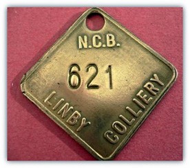
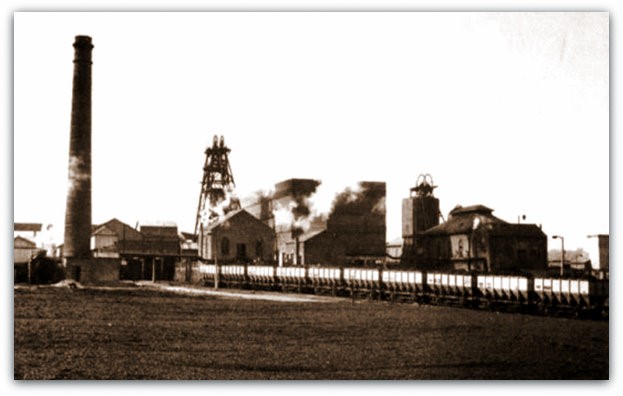
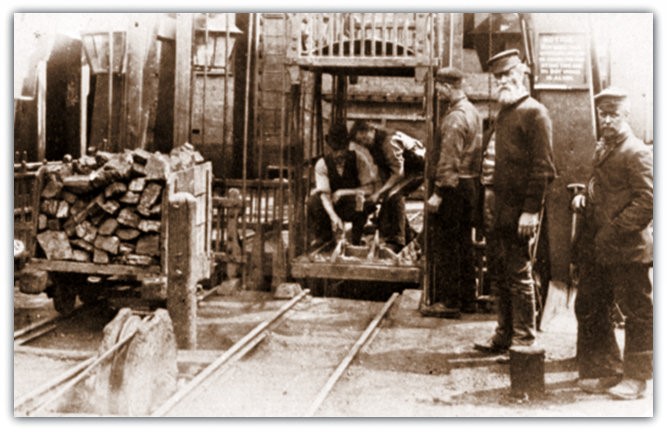
Linby Colliery (Nottinghamshire) to the south of Linby village and to the north of Hucknall and 3.8km north of the City of Nottingham.
Two 14 feet (4.27m) dia shafts were sunk 60 yards (54.9m) apart in 1869-1874, No1 shaft to Top Hard at 432 yards (395m) and sump at the Waterloo horizon 458 yards (419m), by the Linby Colliery Co and was closed on 25th March 1988 after 115 years after producing 400,745 tonnes from the High Hazles with 748 men in the financial year 1987-88.
Production began in 1873 from Top Hard seam at 433 yards (396m) deep.
Shaft positions: SK55SW,
No1 shaft UC N55 02’ 22” lat and 01 12’ 05” lat, NMG 453559, 350139,
No2 shaft DC 453518, 350418. 467 yards (427m).
Surface level 298 feet (91m) above sea level.
Coal production had ceased on 11th March 1988.
In 1947 it was a unit of No6 Area NCB up to April 1967 when it became part of South Nottinghamshire Area.
1988 – Page 9
Bentinck Merged With Annesley

Bentinck Colliery (Nottinghamshire) (locally referred to as Bentick) sunk in 1895-1896 by the New Hucknall Colliery Co to the south west of Kirkby and to the east of Langton ceased production from the Waterloo seam and as a separate unit after 92 years and was merged with Annesley in March 1988, and renamed Annesley Bentinck mine.
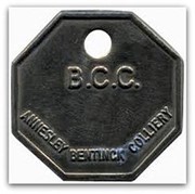
The pits had been connected underground 1980-1981.
Shaft positions: 116m above sea level, SK45SE, 495 yards (452m) deep.
- Bentinck No1 DC shaft 448740, 354963, 4.7m dia
- Waterloo at 223m
- Deep Hard at 348m
- No2 UC shaft 448769, 354969, 462m to Blackshale and used for winding men and materials to Waterloo and Tupton faces
- No3 DC shaft 448799, 354974, sunk to Threequarter horizon at 414m and used for winding men and materials.
Cutters were installed in the Low Main workings in 1920 and by 1923 conveyors also and subsequently in the Deep Soft and Deep Hard by 1930.
Surface plant was changed from steam driven and compressed air to electric in 1931.
Haulages were converted underground by 1937. However compressed air driven cutters were installed in 1938 and changed to electric in 1943.
Workmen were transported home after work via open topped ‘charabancs’ in 1920s.
A canteen and pithead baths were opened in 1936 and a new canteen was opened in 1946.
Prior to nationalisation in January 1947 the colliery was owned by the amalgamation of New Hucknall Colliery Co and Blackwell Colliery Co, named NH and B Collieries Ltd in 1944.
A new coal preparation plant operational in 1968 was at Bentinck and capable of 800 tons per hour and all the coal from the two pits was exited via Bentinck surface drift (started from surface June 1964 at 1in4 for 2,200 yards (2,012m) down to the Blackshale workings, thirling in May 1967) and continued to do so until Annesley producing from the Blackshale seam was closed.
The drift intersected the Waterloo and Tupton workings. The Cementation Co had the contract to drive the drift and according to one of the headers, a holiday acquaintance Andy Steven (a Highlander as he referred to himself, not a Scotsman) who worked in the drift in the late 1960s, Micky Magner was the ruthless Irish shift boss in charge. Others in his team were Hungarians (who came to this country after the uprising in 1956 and hardly spoke any English). They were Zoltan Arkovitch, Charlie Dasas and Louis Kovaks the ‘spanner man’ aged in his 70s and ‘Dirty Dick’ Digman.
‘Dirty Dick’ wore a cheap suit that he had made for him every 6 weeks by a Jewish tailor in Mansfield (probably Jelonek). He wore the suit all the time until it became unfit to wear. He used to dash through the showers in his wellies and some clothing hardly getting wet, hence his nickname, and according to Andy he even wore the suit in bed in the digs in Mansfield where they stayed.
The work was ultimate graft and the firm tolerated no slackers or minor accident cases or they were replaced.
On several occasions the team drilled and fired two pulls of 6 feet (1.80m), loaded out using a big Eimco shovel and set 4 arches in a shift earning them £120 for the week. Similarly advances were made on the other shifts. This was a terrific amount of pay at that time and the NUM officials tried to stop it as they felt it wrong for their members to supply them but of course it was a private contract with no union and no one in the NUM so nothing could be done. Miners at the pit were probably getting about 25.
Drift mouth co-ordinates 43/4855/982060. It was part-filled and capped April 2000.
No2 head bunker was installed in 1973 and wagon controllers beneath the hopper.
Gullick 6/240 chocks were installed underground in 1975. A loading machine was installed on the surface in 1980.
Sinking Details:
Start Excavating 1894 By The Company
- 21 Sep 1894 soil 1’ 0” (0.3m ), clay 4’ 4” (1.32m), bind 11’ 8” (3.55m), fireclay 3’ 4” (1.02m) 6 yds 2’ 4” (6.20m), curb 11 yards (10.0m) No10, bat or smithies coal 1’ 8” (0.50m) @ 14 yards (12.8m)
- 19 Sep 1894 Began sinking by Kellam and Watford, first metal curb @ 50 yards (45.7m), coal 9” (0.23m) @ 29 yds 11” (27.3m), bat or smutty coal 1’ 0” (0.30m) @ 33 yds 2’ 8” (32.6m) 25/9/1894
- Restart 13th Dec 1894 cannel 1’ 4” (0.40m) @ 56 yds 1’ 3” (51.5m)
- 9 Jan 1895, coal 8” (0.20m) @ 63 yds 1’ 3” (58.0m), coal smutty 3’ 3” (1.0m) @ 74 yds (67.7m) on
- 23 Jan 1895, coal smutty 5” (0.13m) @ 76 yds 9” (70.2m), coal 8” (0.20m) @ 101 yds 1’ 2” (93.4m)
- 23 Mar 1895, bright coal 2’ 0” (0.61m) @ 114 yds (104.2m)
- 1 Apr 1895, coal 8” (0.20m) @ 134 yds 2’ 3” (124.6m) 22/4/95, coal 6” (0.15m) sutty @ 139 yds (127.1m) 25/4/95, coal 2” (0.05m) @ 155 yds (141.7m) 13/5/95, wooden bricking curb 4” (0.10m) @ 162 yds 2’ 0” (150m) 16/5/95, smutty coal 1” (0.025m) @ 168 yds 1’ 1” (154.6m)
- 20 May 1895, 5th wooden curb 12” (0.30m), bright coal 6” (0.15m) @ 188 yds 1’ 0” (172.2m)
- 12 Jun 1895, Combe coal 1’ 4” (0.40m) @ 189 yds 2’ 5” (175m) 12/6/95, Butterley Top Hard hollows (gob or goaf) 2’ 2” (0.66m) @ 190 yds 10” (174.5m)
- 13 Jun 1895, total of 100 strata, bright coal 3” (0.076m) @ 200 yds (182.9m)
- 26 Jun 1895, Dunsil seam 2’ 0” (0.61m) @ 209 yds 1’ 9” (192.7m), 3/7/95, hard coal 1’ 7” (0.48m) @ 226 yds 9” (207.3m)
- 12 Jul 1895, soft coal 1’ 2” (0.36m) @ 230 yds (210.3m)
- 13 Jul 1895, cannel coal 2’ 1” (0.63m) @ 239 yds
- 18 Jul 1895, Waterloo seam 1’ 10” (0.56m) @ 246 yds 2’ 11” (227.6m)
- 27 Jul 1895, coal 1’ 9” (0.53m) @ 256 yds (234m) 1/8/95, coal 2” (0.05m) @ 256 yds 2’ 11” (236.75m), coal 1” @ 257 yds 9” (235.2m)
- 3 Aug 1895, coal 3” (0.075m) @ 262 yds 1’ 0” (240m)
- 6 Aug 1895, 5th wooden curb 12” (0.30m) @ 273 yds (249.6m) 16/8/95, cockle bed 1” (0.025m) @ 296 yds 9” (270.9m)
- 3 Sep 1895, 6th wooden curb 12” (0.30m) @ 297 yds 2’ 6” (272.3m) 4/9/95, soft coal 1’ 8” (0.51m) @ 298 yds 1’ 1” (273.5m)
- 4 Sep 1895, 7th wooden curb @316 yds (289m)
- 13 Sep 1895, coal 1” (0.025m) @ 330 yds 2’ 0” (302.4m)
- 24 Sep 1895, 8th wooden curb @ 332 yds (303.6m)
- 30 Sep 1895, coal 5” @ 338 yds 1’ 3” (309.5m) 3/10/95, coal 3” (0.076m) @ 340 yds 2’ 0” (311.5m)
- 4 Oct 1895, 9th wooden curb @ 349 yds (319.1m)
- 11 Oct 1895, coal 9” (0.23m) @ 350 yds 8” (320.6m)
- 15 Oct 1895, Deep Soft seam 3’ 9” (1.14m) @ 362 yds 1’ 5 “ (332.3m)
- 21 Oct 1895, 203 layers of strata, 10th wooden curb @ 366 yds 1’ 10” (336.3m)
- 23 Oct 1895, hard coal 9” (0.23m) @ 374 yds 11” (342.8m), Rattlejack Gee coal 1” (0.025m) @ 380 yds 1’ 4” (348.7m)
- 19 Nov 1895, Deep Hard seam 2’ 4” (0.71m) @ 381 yds 8” (349m), 11th wooden curb @ 383 yds 1’ 10” (351.9m)
- 26 Nov 1895, Piper seam soft coal 1’ 2” (0.36m) @ 390 yds 1’ 3” (357m), 224 layers of strata, 394 yds (360.3m) deep
- 30 Nov 1895, 400 yds (365.75m) deep
- 8 Jan 1896, 13th wooden curb @ 422 yds (385.9m)
- 13 an 1896, cockle bed 9” (0.23m) @ 430 yds 1’ 7” (394.6m), cockle bed 3” (0.075m) @ 433 yds 1’ 2” (397m), 14th wooden curb @ 437 yds (399.7m), dark bind with cockles 2’ 0” (0.61m) @ 437 yds 2’ 10” (402.2m), batty coal 11” (0.28m) @ 438 yds 9” (400.7m), Low Main seam 3’ 0” (0.91m) and 4” bat (0.10m) @ 441 yds 3” (403.3m)
- 21 Feb 1896, coal 1’ 11” (0.58m) @ 444 yds 1’ 10” (407.65m)
- 25 Feb 1896, 15th wooden curb @ 448 yds 1’ 2” (410.7m)
- 28 Feb 1896, stood
- 6 May 1896 Recommenced sinking, soft coal 2’ 4” (0.71m) @470 yds 1’ 4” (430.15m), Blackshale seam coal 1’ 4“, (0.42m) dirt 2” (0.05m) coal 8” (0.20m), dirt 4” (0.11m), coal 1’ 2” (0.36m) @ 495 yds (452.6m)
- 2 Jul 1896 finished sinking @ 508 yds 7” (465m)
Bentinck:
- Deep Soft, 3ft 9in (1.66m) 1905-1956
- Deep Hard (dark blue bind 2”, black bind 3”, Jay coal 1”, coal 2’ 6”, black bat 3”, clunch floor using No2 and No3 shafts 382 yds (349m) via stone drifts from Deep Soft -2nd July 1901 and -1967
- Low Main or Tupton cannel 3”, bright coal 2’ 9”, hard batty coal 3”, strong clunch floor 1895 – 6th Aug 1896 (pit bottom headings) and – 25th Mar 1983
- 2nd Waterloo 1907-1988, and Blackshale (using Low Main shaft 442 yds (404m) dirt 4”, coal 1’ 1”, dirt 1”, coal 10”, dirt 1”, coal 6”, dirt 1”, coal 8” -2nd July 1901 and 1988 (cont’d at Annesley).
Connections were made to Langton, Brookhill in Aug 1968 (then the shaft filled) and Newstead later.
Dirt was transported from the Coal Preparation Plant to the dirt tip by 42” (1.07m) wide conveyor to a 100 tons capacity bunker and also one of 400 tons from where it was transported up the tip by 36” (0.91m) wide conveyor to be spread by bulldozer and 2 Euclid TS24 scrapers, 20 hours per day.
Rapid loading bunker commissioned 1980 and Coal Prep Plant cost £6m.
The 3 shafts at Bentinck as per New Hucknall had been sunk at 14 feet (4.27m) dia, No1 to Deep Hard at 381 yards (348m), No2 to Blackshale at 505 yards (462m) and No3 to Threequarter seam at 453 yards (414m), this shaft using a Grange Iron Co engine to June 1977.
2 new identical Aerex 9 feet (2.795m) dia single inlet with backward angle bladed radial fans and 1,600hp motors at 735 rpm at No2 shaft top, installed 1973. At Langton the 11’ 3” (3.43m) single bladed inlet backward radial fan installed in 1959, also booster fans at UC shaft. Electrification of the three winding engines was completed in Dec 1978.
A Training centre for new entrants into the industry for some of the pits in Nottinghamshire opened after 1947. A new larger training centre was established in 1965.
Surface locos on 4’ 8” gauge were side tank engines
- No2, 0-6-0 1893
- No3 Jubilee 0-6-0 1897
- New Hucknall No4, 0-6-0, 1905
- Huthwaite 7, 0-6-0 1917, 0-6-0, 1917
- Bentinck No1, 0-4-0, 1900
- Bentinck No2, 0-6-0, 1931
- Bentinck No3, 0-6-0, 1928
- LNER 985, 0-4-0, 1923
- EMFOUR 3, 0-6-0, 1954, 0-4-0 diesel 1958
- Annesley No2, 0-6-0, 1937
- Daisy 0-4-0, 1906, 0-4-0, 1966
- EMFOUR 9, 0-6-0 1958.
1988 –
Bentinck Merged With Annesley
– Continued –
A pumping station was set up at Bentinck to collect water from surrounding mines. Four 6” (0.15m) dia boreholes were drilled by the Area boring team to connect Babbington and Moorgreen so that pumping could cease at Babbington and the water would migrate to Moorgreen. Six 4” (0.10m) dia bores were drilled to connect Moorgreen to the Annesley Bentinck complex to allow all the water from Moorgreen and Pye Hill to migrate there to the new pumping station.
Water was collected also from other neighbouring pits via Langton and via Langton from A Winning another major collecting point and pumping station. All the water was then pumped to Annesley raised there and settled in lagoons before being piped 11km to Bobber’s Mill and into the River Trent as permission to discharge all the water into the nearby River Erewash had been refused by the Rivers Authority on the grounds of impurity etc. This was a very costly project requiring wayleaves and rents etc and laid alongside the railway lines but was necessary for keeping the pits open.
Water at Langton was collected from Pinxton, Brookhill and New Hucknall and Kirkby and that too was to migrate to the lodge. The idea was to protect collieries that lay to the dip side eventually through roadways or goaf connections such as Newstead and Calverton. It was pumped through the new pipeline eventually to the River Trent as required under the Control of Pollution Act 1974, Part II mentioned previously.
A surface triangulation survey from Annesley / Newstead overland to Bentinck was carried out. The heading from Newstead Colliery thirled with the heading from Bentinck Colliery on 17th November 1984. A connection survey was made from bases in Newstead High Main to Bentinck Waterloo bases, There was a difference of 14 seconds in bearing and the difference in co-ordinates was 0.006m in Eastings and 0.027m in Northings and the difference in level was 0.07m, in other words an absolutely spot on job and credit must go to the Surveyors at both pits for their surveying attributes. Unfortunately surveyors are not expected to make any errors or mistakes in the eyes of Mining Engineers. These people have all made many mistakes in their time but they were generally put right by either blaming the equipment or geology or some poor downbeat Official. Losing several face chocks costing thousands of £s each by deliberately leaving them behind in a packhole was a ‘necessity’. They would just write a report about it and file it and carry on. Money did not seem to matter.