This is the second piece on the web site regarding the damage to English Civil War archaeological sites in Newark on Trent. The letter below comes from a person at Lincolnshire County Council who has advised Newark and Sherwood District Council on archaeological issues. The letter attempts to downplay what has happened to two redoubts close to the River Trent brought about by the installation of a hydroelectric generating scheme at the Canal and Rivers Trust’s Nether Lock. The letter was received by one of the archaeologists we have been assisting at Newark over the last number of years.
I provide Newark and Sherwood District Council with archaeological advice in relation to planning, and your concerns regarding the works at Nether Lock have been raised with me to investigate further. I thought it best to email you directly.
Having reviewed the site locations you’ve kindly provided; I can confirm that these do not form part of the listed scheduled monument relating to the Civil War redoubt which is located 150m to the north west of the site. I have not been able to access the scheduled monument on foot, but it seemed intact and undisturbed when viewing it from the A46 bridge last week. If you have any further evidence of the scheduled monument being disturbed, please forward it on as a matter of urgency.
I’ve also reviewed the drone footage (many thanks for this), Google Earth aerial photos going back to 1999, historic mapping, LIDAR data and of course the data held on the Historic Environment Record.
Unfortunately, there is no record of these sites on the HER and consequently my predecessor did not advise that there should be a requirement for archaeological work placed on the development, other than to confirm the works would not impact on the scheduled monument to the north west.
Further, given the disturbance from construction of the railway and the A46 it is unlikely, in the absence of any other evidence, that a refusal of the application on heritage grounds would have been justified, and any such refusal would almost certainly have been overturned on appeal.
In your emails to Chris you have described the sites as well preserved Civil War redoubts in fabulous condition and that the western one has been obliterated and the eastern one partly damaged by vehicles, but otherwise intact.
The drone footage does not provide any clear evidence for surviving earthworks on the site to the east of the compound. The discolouration of the grass can indicate underlying archaeological remains, but this is not present on the earlier aerial photographs of the site. The aerial image you supplied showing the earth works is a relatively recent google earth image and earlier, higher resolution images, do not show any of the earth works identified.
More importantly from an archaeological perspective, the western site identified is also on the site of a sluice channel shown on the Tithe and 19th century maps. The construction of this channel would have destroyed any civil war earthworks and buried archaeology if present so I would suggest that the earthworks/cropmarks indicated are highly unlikely to relate to Civil War earthworks. The channel has subsequently been filled in which constitutes a further disturbance event for the site.
There is also no indication of these sites as earthworks on the current LIDAR images for the site which I would expect to see. Other known Civil War redoubt sites on the HER show up very well.
I’ve attached the google earth images, mapping and LIDAR image referred to above in support and for your review.
I wholeheartedly support the reporting of sites of archaeological interest by members of the public and strongly recommend that they engage in the first instance with the Historic Environment Record so that further investigation can be undertaken. Reporting of such sites to the HER is key to protecting them, especially when it comes to making decisions in planning. As I’m sure you are aware, the vast majority of archaeological remains are not scheduled or listed and therefore not offered any protection in law (unlike environmental issues) and the planning guidance (National Planning Policy Framework) in relation to heritage is considered best practice rather than a legal requirement. It is therefore imperative that as advisors we are given as much evidential information as possible to argue in favour of archaeological work on sites where it should be undertaken and can be justified within the current planning process. The HER forms the core of this evidence.
I appreciate your concern for this site and welcome the awareness you’ve raised in regard to it, however in this instance I would regrettably advise that the evidence provided thus far does not support the conclusions that these sites are the remains of significant earthworks associated with Civil War defences or of an archaeological nature in general. I would suggest that the site has been heavily disturbed by the sluice channel construction and infilling, the railway construction and finally the A46 bridge construction and any earthworks that might have been on the site have long since been levelled.
I would of course be happy to view further evidence if it is provided.
Best wishes
Correspondent’s name withheld to protect their anonymity.
Lincolnshire County Council
County Offices, Newland, Lincoln LN1 1YL
Website: www.lincolnshire.gov.uk
The letter is somewhat condescending in its tone and wishes to stop any further furore with regard to the care of archaeological sites and the lack of required archaeological investigation where a site is likely to be damaged or destroyed. The possible presence of archaeological remains has been downplayed across the Newark area due to poor desk top studies and reports submitted by the applicants of planning applications. Similarly, the planning department of the council are apparently outsourcing views on planning applications to outside agencies, in this case Lincolnshire County Council rather than using the Nottinghamshire County Archaeologist.
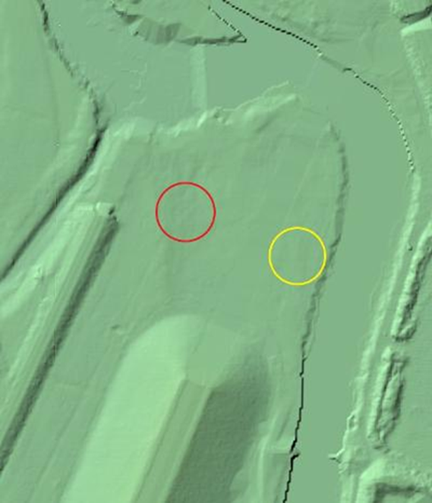
Lidar image of the area about the site in question supplied by Lincolnshire and stated as having no evidence of earthworks of relevance. It is though, on inspection to demonstrate several features. The problem with all photographic views is that there is always variation, light, placement of the sun, climatic condition, flood, or drought, all affect the outcome.
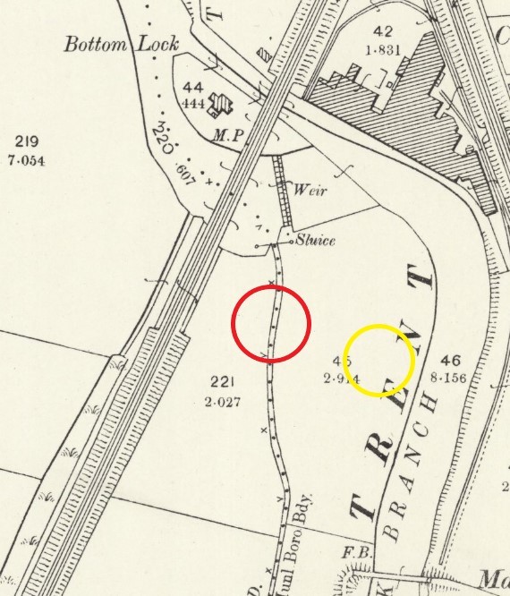
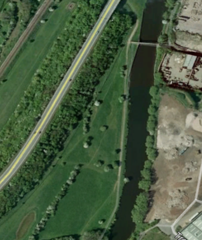
The map as supplied by Lincolnshire; shows the presence of a sluice This was likely to stop backflow along the parish boundary ditch. The boundary being fixed along this paleochannel and not the Trent at this point. This ditch or drain is likely to have silted up rather than been filled. Due to its formation at an earlier period of the Islands development. The ditch would have been in existence during and prior to the Civil War. The letter states any earthworks would likely have been destroyed by the filling in of the ditch and the building of the A46 bypass. As may be seen on the image from Google Earth (next image) the ditch still exists as a hedge line which is only cut through by the road. The road construction did remarkably little if any damage to the land on either side of its route as this was fenced off and contractors barred from entry.
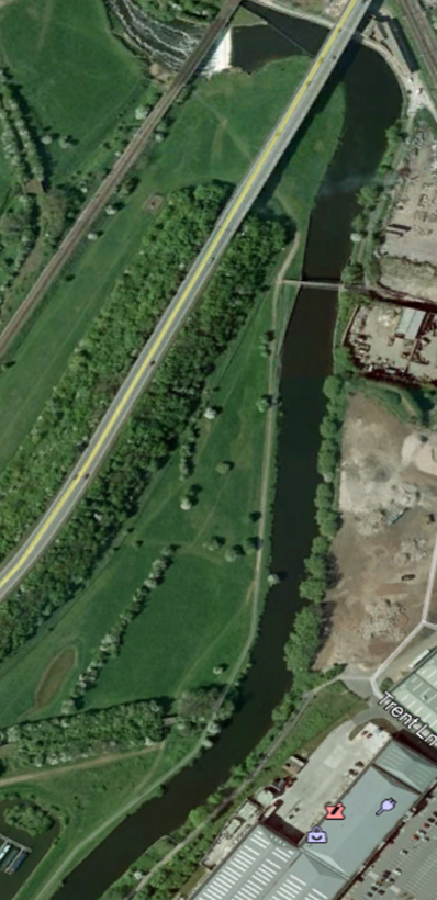
Google Earth 2020.
The reason for the channel to be so heavily emphasised on maps is that it is a parish boundary.
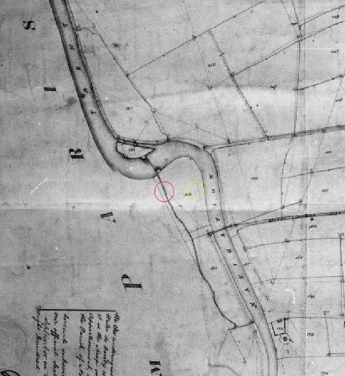
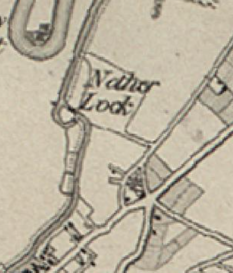
Tithe Map supplied by Lincolnshire County Council, (2021)
This plan demonstrates the paleochannel having a linkage to triangular ditch / system which bears remarkable similarity to a Civil War structure at its southern terminus. The definition of the ditch is a demarcation of the parish holdings to be taken into account when calculating and gathering tythes.
The land holding on the Island was complicated as might be witnessed by the next map. This illustrates village holdings of rights of use to surrounding parishes, but also East Stoke which lies beyond the parish of Farndon on the Nottingham Road. The Farndon portion being landlocked by the three other parish lands.
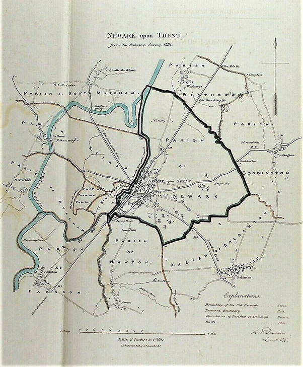
The map above demonstrates the parish boundaries and possible Saxon or early medieval panage or other land holding rights on the Island.
1856 OS
The above map may well show land holdings within the Parish of Newark which are beyond the Trent but within the curtilage of the parish. Again, demonstrating its likely silted nature and the size of the holdings.
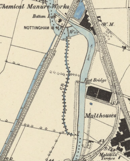
1884
The above map shows no actual physical link to the Trent at its southern end and is only linked via its political purpose. The Trent Dyke by the railway to the west demonstrates mirroring of paleochannels.
This map demonstrates the navigable nature of the River Trent with the foot bridge and paths either side of the river channel. The use of horses through the town was usual due to the mast of Trent Trows having to be lowered passing through the lock and Town Bridge.
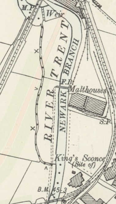 ‘
1899 OS
These following maps similar to the previous OS map. Except the sluice has been removed. The ditch would likely have become totally silted up and the sluice redundant.
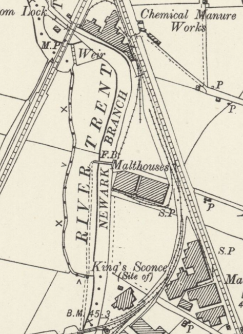
1900 0S
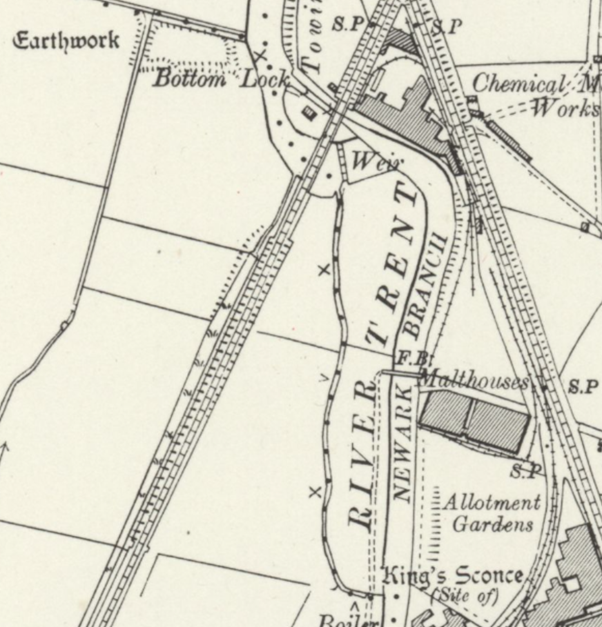
1921 0S
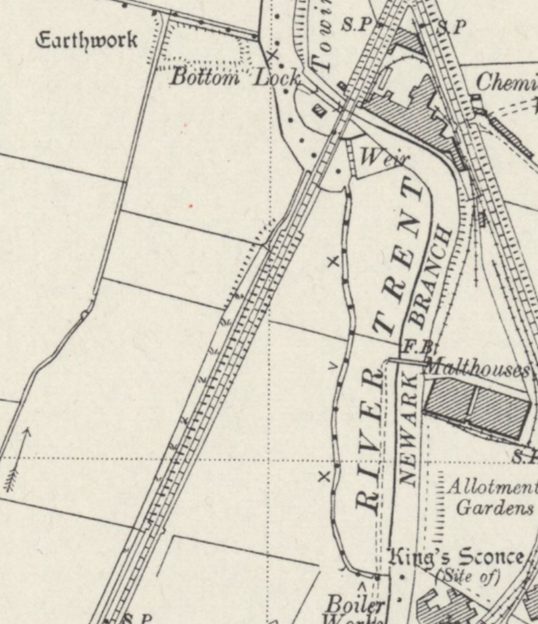
1947 OS
Conclusion.
There is a need to get some resolution to this event so that the continued destruction of archaeological sites around the town ceases and that a proper investigation of the new sites proposed for development are carried out in a timely manner.
The Planning Department at Newark and Sherwood District Council are of a similar mind. Meetings are proposed to take this further and start to resolve the issues and actions will be taken to stop events such as this reoccurring into the future.
It is a puzzle why a Nottinghamshire district uses Lincolnshire County Council advisors rather than the expertise of Nottinghamshire County Council’s Archaeologist?