The reason for this piece of writing was brought about by our monitoring the countries that had visited our web site. Over 155 nations have. It crossed our minds that our site may have no immediate relevance to a researcher in any of these missing nations who have not visited our site. This article hopefully addresses some of these shortfalls.
Several of these countries may not have easy access to the internet and/or are suffering from issues of conflict or government aversion to the world-wide web. Even in the midst of war Ukrainian research into many pollution issues, including mine water pollution continue despite the Russian invasion of that country.
Montenegro.
Half the rivers of Montenegro are part of the Danube catchment, the others are part of the Adriatic Sea catchment. Those that flow towards the Danube include the rivers Tara, Piva, Lim, Ćehotina and the Ibar. The International Commission for the Protection of the Danube River (ICPDR) is involved in the partial care of rivers entering the Danube catchment to cut pollution and encourage a sustainable water resource.
The major non-Danube river is the Zeta River that flows from and through the central karstic plain a geological structure drains the centre of country and is fed by the northern and southern mountain ranges. It flows out into the Adriatic as the Bojana-Buna River and delta and the border with Albania.

The Zeta river system is still only just starting to be understood. The limestone rock allowing the water to flow at different horizons from the surface down and through the solute channels. The major lake on the border with Albania, Lake Scutari (Lake Skadar) is a remarkable setting for diverse freshwater bivalves and other fauna, including the only European pelican population.
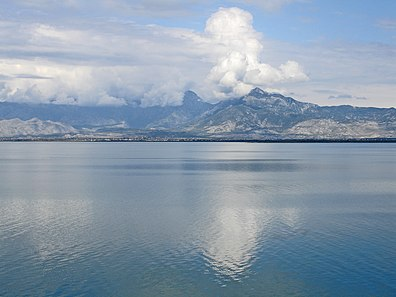
In the 1980s Albanian fishermen crossed the lake to the Montenegro shore to shoot many hundreds of cormorants that had established themselves in roosts along the lake fringe and up river. These invasions were major concern at the time with these de facto invasion of what was then Yugoslavia by another nation. The destruction of these nest sites and the death of birds proved ineffective, by 1994 the estimated population of cormorants had mor than been made up by nearly double the number killed.
River pollution is only just becoming an issue in the country, the ICPDR state that rivers’ water quality flowing into the Danube basin are of reasonable quality. Problems that are known are brought about due to the growth of town and city populations without the corisponding development of better urban sewage treatment systems.
Greenland (Kalaallit Nunaat).
Greenland is a satellite country (though automatous for all thing except foreign affairs and defence) of Denmark.
The majority of its residents are Inuit, whose ancestors migrate from Alaska through Northern Canada, gradually settling across the island by the 13th century. The population is small, being around 56,500 people whilst the islands area is large, 2,667,000 square kilometres.
Most river systems across Iceland are frozen for most of the year at least, many never thaw at all, and others are presently being developed by the many glaciers and icesheets that are present across the land. This remarkable overlay of present and future waterways is further complicated by recent research findings that demonstrate there are several, including one thought to be over 1600 kilometres in length that flow beneath the ice cap and are fed by waters welling up from deep warm springs in the islands interior.
Mercury in meltwater from the south eastern edge of the Greenland icesheet are at the present attracting attention as they levels are both high and concerning as they are when reaching the sea building up in the waters of coastal fiords. This build up is concerning as it is contaminating fish stocks that are being caught and consumed by the local communities. The contamination is believed not to be from an atmospheric source but a natural deposit somewhere in the area beneath the ice.
Mining activity in the country has been limited ti the western, southern and eastern coasts where materials as diverse as gold and silver, coal and zinc have been won in very challenging conditions.
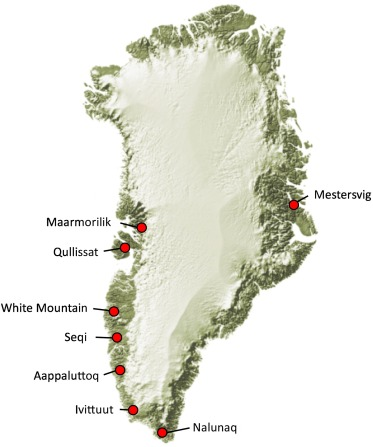
The mines have all been monitored since their closures (1970s to early 2000s). some mines have proven to have adversely effected the environments around their locations but due to the frozen nature of the sites for much of each year the damage has been considered small in the majority of cases. With the onset of global warming though this is considered likely to change. Sulphidic bed of ore are now expected to produce highly acidic drainage from some of the workings and rock spoil heaps. Some of the latter may also become liable to major collapse.
The present government has recently (2022) demonstrated an aversion to applications to mine uranium at several locations in the country.
Faroe Islands.
The Faroe Islands (similarly to Greenland) is a self-governing archipelago, part of the Kingdom of Denmark. It comprises 18 rocky, volcanic islands between Iceland and Norway in the North Atlantic Ocean. The population is 49,000.
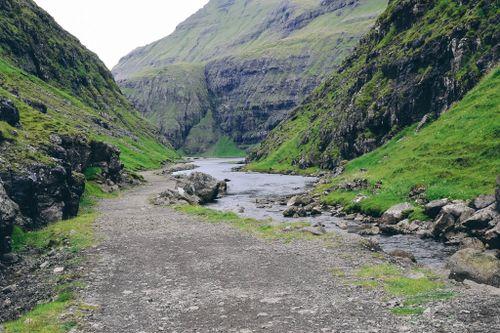
The islands are kept ice free by the Gulf Stream or North Atlantic Current. Sea temperatures range from 6oC to 12oC. The main industries in the islands are based around fishing and this also includes a growing tourist industry based around salmon fishing. The watercourses are mainly near pristine as there are few habitations and pollution inland of the coast.
Tórshavn the capital of the Faroe Islands is taking part in a pilot scheme that looks to cut back on pollution, from traffic management to waste water treatment. As the city is has a small population of 22,000 and lack of beurocracy trials and responses to events can be initiated swiftly. If such actions prove to to work they then are tried in Reykjavik, the capital of Iceland with a population of 100,000 more. If a scheme works well in scaling up it will be adopted by other Scandinavian countries.
Tajikistan.
A country of ancient origins whose last 150 years has been dominated by Russian influences, initially Imperial, later Bolshevik and then as part of the USSR. Today after several hiccups it is independent though under near totalitarian rule of its president.
Economically it has suffered agricultural experiments, cotton replacing cereal production has ensured that its population has had to rely on grain imports to feed its population. Its biozones cover a wide variation of types from mountain desert and tundra through forest to steppe.
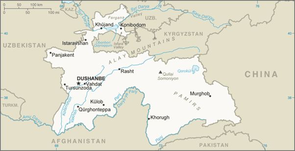
In Tajikistan’s dense river network, the largest rivers are the Syr Darya and the Amu Darya; the largest tributaries are the Vakhsh and the Kofarnihon, which form valleys from northeast to southwest across western Tajikistan. The Amu Darya carries more water than any other river in Central Asia. The upper course of the Amu Darya, called the Panj River, is 921 kilometres (572 mi) long. The river’s name changes at the confluence of the Panj, the Vakhsh, and the Kofarnihon rivers in far southwestern Tajikistan. The Vakhsh, called the Kyzyl-Suu (“red water” in Turkic languages) upstream in Kyrgyzstan and the Surkhob in its middle course in north-central Tajikistan, is the second largest river in southern Tajikistan after the Amu-Panj system. In the Soviet era, the Vakhsh was dammed at several points for irrigation and electric power generation, most notably at Norak (Nurek), east of Dushanbe, where one of the world’s highest dams forms the Nurek Reservoir. Numerous factories also were built along the Vakhsh to draw upon its waters and potential for electric power generation. Due to the uneven distribution of water throughout Central Asia, the Soviets created a system in which Kyrgyzstan and Tajikistan provided water to Kazakhstan, Turkmenistan, and Uzbekistan in summer, and these three countries provided oil and gas to Kyrgyzstan and Tajikistan during winter. After the collapse of the USSR in 1991, this system fell apart and a new resource-sharing plan has yet to be put in place. According to research conducted by the International Crisis Group, this is due to corruption and lack of political will; failure to solve this issue could lead to irreversible regional destabilization.
The two most important rivers in northern Tajikistan are the Syr Darya and the Zeravshan (Zarafshan). The former, the second longest river in Central Asia with a total length of 2,400 kilometres (1,500 mi), stretches 195 kilometres (121 mi) across the Fergana Valley in far-northern Tajikistan. The Zeravshan River, with a total length of 781 kilometres (485 mi), runs for 316 kilometres (196 mi) through the north-centre of Tajikistan. Tajikistan’s rivers reach high-water levels twice a year: in the spring, fed by the rainy season and melting mountain snow, and in the summer, fed by melting glaciers. The summer freshets are the more useful for irrigation, especially in the Fergana Valley and the valleys of southeastern Tajikistan. Most of Tajikistan’s lakes are of glacial origin and are located in the Pamir region in the eastern half of the country. The largest, the Karakul (Qarokul) Lake, is a salt lake devoid of life, lying at an elevation of 4,200 metres (13,800 ft). Tajikistan’s second largest water body is the Kayrakum Reservoir, a 44 km (27 mi) long artificial lake in the heart of the Fergana Valley, not far from the city of Khujand in Sughd Province. The lake is fed by the Syr Darya. Another well-known natural lake of glacial origin is Iskanderkul. It is smaller than the Kayrakum Reservoir and lies in the Fann Mountains in western Tajikistan.
In 2010, 64% of the Tajik population had access to potable water, 54% in rural areas and 92% in cities.[6] Water shortage first became a threat in Tajikistan under the Soviet Union’s pressure to expand cotton cultivation in Central Asia. During this time, minimal regulation on water use was implemented and much of it was allocated towards irrigation. The Tajik government has since expanded limits on water use, however the agencies involved in their application lack the effective judicial and legal systems necessary to implement them.
Agriculture accounts for 90% of Tajikistan’s water use, and 33% of Tajikistan’s irrigated land is used to cultivate cotton. Much of Tajikistan’s irrigation and water treatment systems have not been updated since the end of the Soviet Era, after which a catastrophic civil war ravaged much of the countryside and further damaged already corroding infrastructure. Cotton irrigation uses a majority of Tajikistan’s water resources, however the equipment used for irrigation, being outdated, is inefficient and loses a majority of the water it carries. Tajikistan has been slow to update these water systems due to a multitude of political and economic factors, such as a limited budget and mounting debt since the conclusion of the civil war. Additionally, Tajikistan has undergone pressures to cultivate less resource-heavy crops, which have been met by resistance from a politically influential cotton industry.
Climate change is expected to particularly affect Central Asia in terms of water scarcity. By 2030, demand for water sourced from glaciers in Tajikistan is projected to increase by a third, while glacial runoff is expected to decrease by 30%. As a result, Tajikistan’s water use has complicated its relationship with its neighbours. Irrigation, in addition to the construction of hydroelectric dams like the Rogunon the Vakhsh, Panj, and Amu rivers without consultation, has resulted in water shortages and public outcry in Uzbekistan and Turkmenistan, as well as contributed to the shrinking of the Aral Sea. At present, projections by the World Bank indicate that annual average temperatures could rise 5.7 degrees Celsius by the year 2085.
13% of Tajiks have access to public sewage and 34% are without indoor plumbing or lavatories, resulting in 38% of the population depending on water from potentially contaminated sources and subsequent outbreaks of typhoid and cholera. This lack in infrastructure dates back to the Soviet Era and was exacerbated by poverty and civil war. Other causes of water and air pollution include pesticides (particularly DDT and HCH) and fertilizers in surface runoff (exacerbated by landslides from soil degradation), industrial waste, burning of fossil fuels, and tailings from former Soviet mining operations.
Most polluted rivers in Tajikistan cross into several other Central Asian nations and are therefore a transnational problem; the Navruz experiment in 2000, which involved several Central Asian governments, discovered high levels of metals and radionuclides in the Aral Sea river basin.[8] Otherwise, regional approaches to pollution have been limited. After the dissolution of the USSR, the region-wide network of data collection posts was fragmented, which, in combination with the destruction of hydroposts during the civil war, has restrained Tajikistan’s access to information on pollution in its rivers and its subsequent response.
Consequently, Tajikistan’s regional relationships have become tense. In 2005 the Uzbek government blamed Tajikistan’s industrial pollution for problems in its ecosystems, public health, and agriculture. Uzbekistan has since insisted on operating under a 1994 agreement that required the neighbors to manage transnational environmental problems together, however Tajikistan maintains that its industry has had no impact on the environment and that the operation of its industrial sector is an exercise of sovereignty.
Turkmenistan.
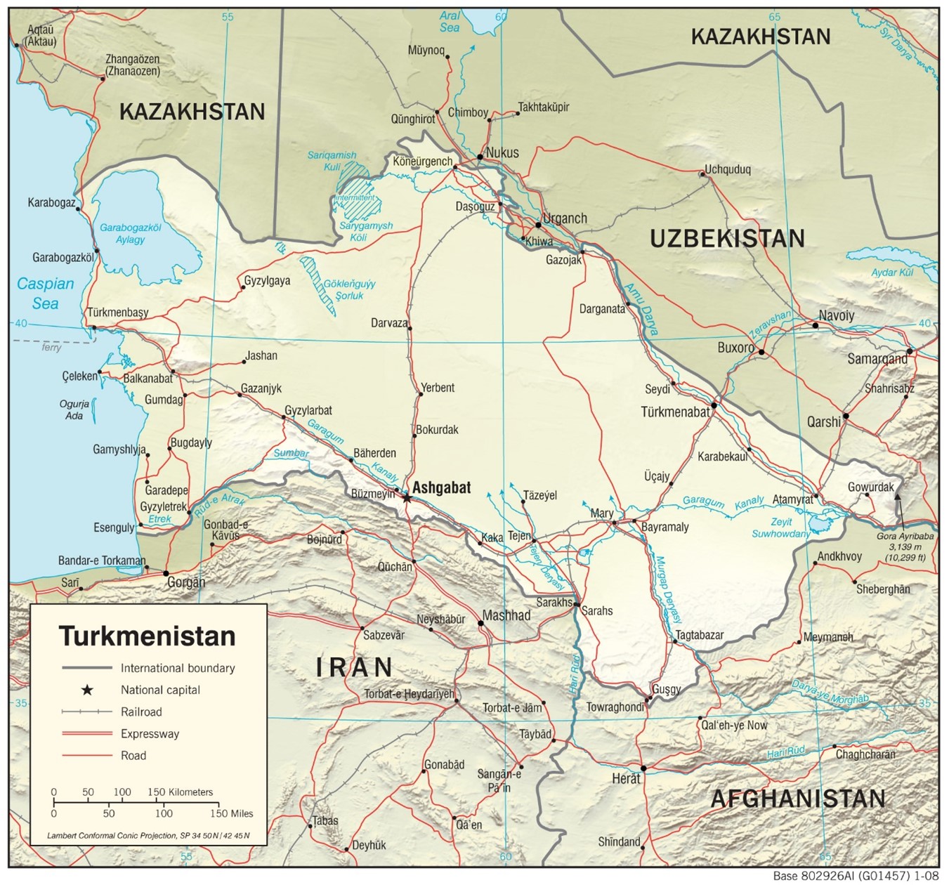
Environmental issues in Turkmenistan are most visible in three significant areas: desertification, the drying of the Aral Sea, and chemical pollution. All three of these areas are directly linked to agricultural practices in the country.
Only the Sahara Desert in Africa has a higher rate of desertification than that of Central Asian deserts. Of these, the Karakum Desert and Kyzyl Kum Desert in Turkmenistan grow by hundreds of thousands of acres annually. These conditions persist due to inefficient agricultural irrigation and cattle grazing practices, which have led to the salinization of soil and the removal of ground cover plants respectively.
Inefficient irrigation techniques on the Amu Darya also contribute to the continued drying of the Aral Sea. Daşoguz Province experiences the most problems due to this drying. Drinking water quality has plummeted, bacteria levels in water have risen, and rates of infant mortality, hepatitis, and illness have risen.
Excessive use of fertilizer on cotton and other crops, as well as the use of pesticides such as DDT causes a large chemical pollution problem. Many fertilizers and pesticides have entered groundwater supplies via leaching or runoff from farms due to excessive or improper use.
Western Sahara.
The Tamanrasett River
In the south of this disputed country, close by the border with Mauritania it is now believed ran a lost river of Africa. It was a major waterway before the Sahara was formed. Its main source of flow was from the Atlas Mountains in modern day Algeria, the rest coming from the high groundwater levels present in the grass land areas which have long since become Desert.
This palaeoriver is thought to have been comparable with the present-day Ganges-Brahmaputra river basin. It is believed to have lost its integrity around 5000 years ago when it was subsumed into the desert.
The river gained its name from the city of Tamanrasett the oasis capital of the largest province in Algeria. A centre of camel routes and the home base of Algerian Tuareg.
A large underwater volcanic eruption on January 15, 2022 in the Pacific island nation of Tonga created a planetary shockwave that circled the Earth at least three times over several days. The antipode of the pressure wave was in Tamanrasset. The initial wave reached the city approximately 18 hours after the explosion.
At the hight of the Algerian civil War the French carried out two nuclear tests including their first in 1960 100 km north of the city. The second wasd carried out underground only 50km away. The second test was meant to have been sealed in but the cement plug vaperised and two jets of flame were witnessed shooting out of the desert. Several French witnesses and other personell including two ministers were irradiated along side innumerable Algerians. The dust cloud contaminated a wide area of the Sahara.
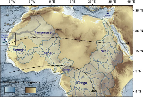
Two Other Rivers of Western Sahara.
Rising within the country close to the border with Mauritania, it is at best a seasonal watercourse or wadi. At times it does discharge into the Atlantic but for years at a time it and its tributaries are dry.
Khatt Atui.
This is likely to be the lower vestigial Tamanrasett River passing into the ocean just beyond the border in Mauritania. For much of the yearvit is dry.
Senegal.
The Senegal River
The Senegal River is a 1,086 km long river in West Africa; much of its length marks part of the border between Senegal and Mauritania. It has a drainage basin of 270,000 km², a mean flow of 680 m³/s, and an annual discharge of 21.5 km³. Important tributaries are the Falémé River, Karakoro River, and the Gorgol River.
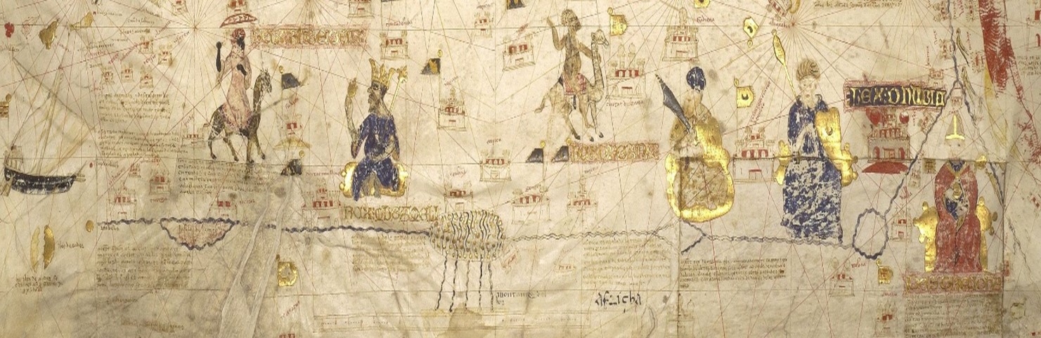
An Islamic map of the river.
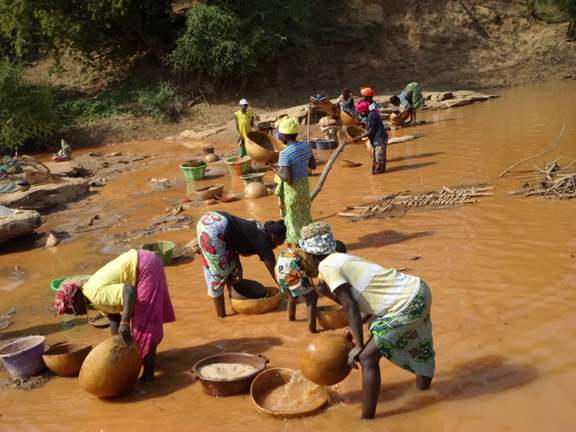
The Falémé River is polluted for large parts of its length due to illegal gold panning and other sediment mineral extraction. The volumes of silts discolours the river for miles below each mine camp. The river has little or no life present due to the loadings of contaminated water.
The Gambia.
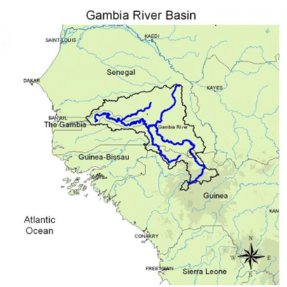
The Gambia River (formerly known as the River Gambra) is a major river in West Africa, running 1,120 kilometres (700 mi) from the Fouta Djallon plateau in north Guinea westward through Senegal and The Gambia to the Atlantic Ocean at the city of Banjul. It is navigable for about half that length.
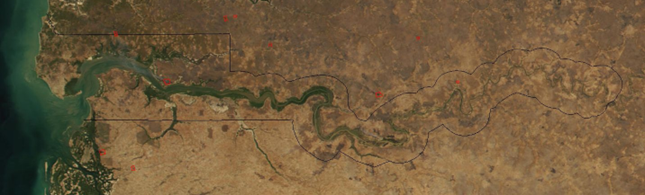
The western River Gambia from space.
The river is strongly associated with The Gambia, the smallest country in mainland Africa, which consists of little more than the downstream half of the river and its two banks (Wikipedia).
There is an ongoing development up stream of the Gambia;the Sambagalou hydroelectric dam – a 368MW dam which will be connected to power networks for The Gambia, Guinea, Guinea Bissau and Senegal. The environmental damage from this scheme is raising major concerne outside the region but within the area its construction is seen a a major necessary development.
Guinea-Bissau.
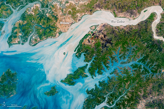
The rivers of Guinea Bissau carry large natural organic sediment levels, both organic and mineral which make the waters appear unnaturally blue in photographs from space, the colour infact changes with the season with yellow being another unusual hew.
Much of the estuarine mangrove marsh/wetlands are under threat from agriculture, especially along the Rio Geba where industrial scale rice production is carried out. This concern is expected to escalate with the issues of global warming. The loss of coastal and estuary mangroves leaves the population of the country at risk of higher sea water levels and at risk from periodic floods.
Mauritania.
This country has no permanent waterways discharging to the sea except the Senegal River which makes up much of the boundary with the country of the same name. The are though a number of salt lakes in the interior., and Lake Rkiz being the two largest, both sitated in the southwester part of the country..
Lake D’Aleg was once part of the Senegal River which is fed by what was a tributary, the Oued Katchi which drains a catchment of mor than 2,000 square kilometres. The river is seasonal and for much of the year is dry. It is now isolated from its former catchment by a range of sand dunes. The lake itsels is semi permanent, growing and contracting with the seasons. It is important as a stoping point for migrating birs heading to and from Europe, as is Lake Rkiz.
Lake Rkiz is also semi permanent. Over 30 kilometres long and 8 wide. It has important wetlands around its shore. The communities around the lake fish, whilst the waters host Slender Snouted crocodiles and many species of snake abound the stands of reed. The reeds are harvested in parts and used for thatching.
Togo.
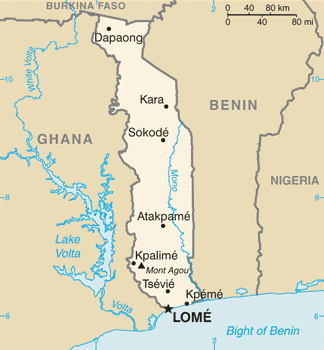
This small West African nation, prior to the First World War made up half of German Togoland founded in the late 19th century, which was divided in 1918/19 between Britain and France. The nation gained independence from France in 1960.
The country has an established minerals industry that concentrates on the winning of phosphates for export. The nations has a diverse agriculture from grain to coffee, cocoa and peanuts; these last three are exported making up 30% of the county’s income. The country is underdeveloped (World Bank), lack of electricity generation capacity and reliance for supply from neighbouring nations ensures a low income population.
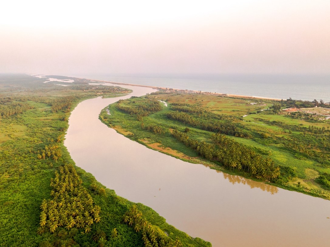
The Main river of Togo is the Mono River which flows from the north to the coast in the south. The Mono for part of its route to the sea makes up the border between Togo and Benin.
The main issues regarding water in the country is poor sanitation, the common practice of defecation in streams and other waters leads to a large number of deaths annually. Many NGOs are trying to educate te population in the care of the water resources but in many parts of the country are having limited effect..
Benin.
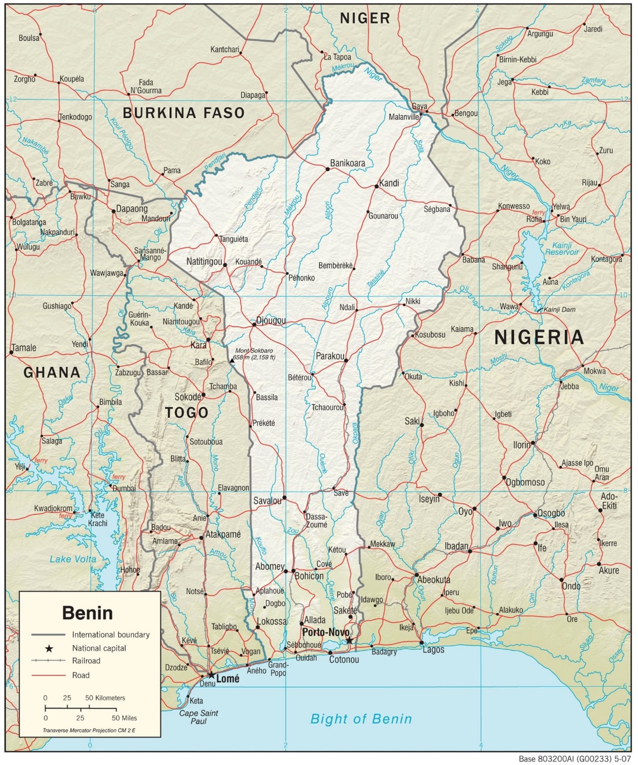
The rivers of Benin are separated by an east west watershed located midway in its length. North south. The northerly flowing rivers are all tributaries of the Niger River that also flows along part of Benin’s northern border with Niger. All those rivers rising on the southern edge of the watershed flow south to the Bight of Benin.
The country relies on subsistence agriculture to feed the nation and cotton as its one major export to bring in 40% of export earnings.
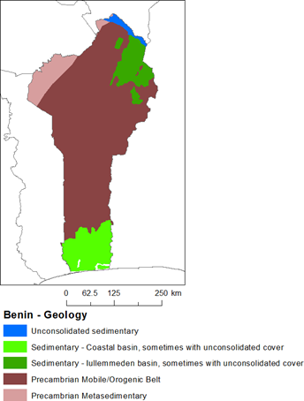
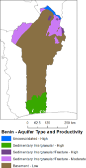
Benin is remarkable for its care of water supply and treatment of domestic waste waters. It is considered by the World Bank to be using aid funding and practical aid from NGOs more creatively and practically than most other Sub-Saharan African nations. In 2017 57% of rural dwellers had access to safe piped water, 80% of urban dwellers also have clean water supplies. Local authorities and the government work together with an independent company to deliver these levels and the company acting as the hub is tasked to get to 90% by 2030. Urban sewage systems are being developed at a rate unknown by other African countries.
Rural agricultural practices and sewage pollution are having an adverse effect on water quality, some of which effect local fisheries. The planned expansion of wastewater treatment into rural areas alongside a more cautious approach to the use of some agriculture chemicals will water quality to improve.
Central African Republic.
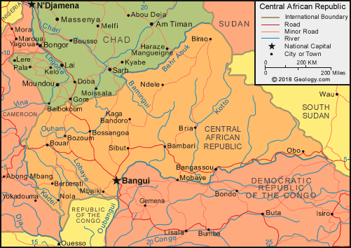
The Central African Republic is one of the poorest nations on the planet. The majority of the population rely on subsistence farming. The country is the unfortunate beneficiary of corruption, civil war and armed banditry. It is considered by many to be the least safe country to visit. The care of the waters of this benighted country are very unimportant to most of the population and this is reflected by the government.
The World Bank and other external organisations face a constant uphill struggle to ensure human health and the water environment are taken as important. Remarkably 75%of the population have access to water that is fit to drink but that is threatened by the reality that only 25% of the population have some form of sanitary provision. The population are prone to faecal illnesses.
| 1997 | 2005 | 2014 | 2015 | |
| Rural population with access to safe drinking water (%) | 54.4 | |||
| Urban population with access to safe drinking water (%) | 89.6 | |||
| Population affected by water related disease | No data | No data | No data | No data |
| Total internal renewable water resources (cubic metres/inhabitant/year) | 28,776 | |||
| Total exploitable water resources (Million cubic metres/year) | No data | No data | No data | No data |
| Freshwater withdrawal as % of total renewable water resources | 0.0514 | |||
| Total renewable groundwater (Million cubic metres/year) | 56,000 | |||
| Exploitable: Regular renewable groundwater (Million cubic metres/year) | No data | No data | No data | No data |
| Groundwater produced internally (Million cubic metres/year) | 56,000 | |||
| Fresh groundwater withdrawal (primary and secondary) (Million cubic metres/year) | No data | No data | No data | No data |
| Groundwater: entering the country (total) (Million cubic metres/year) | ||||
| Groundwater: leaving the country to other countries (total) (Million cubic metres/year) | ||||
| Industrial water withdrawal (all water sources) (Million cubic metres/year) | 12 | |||
| Municipal water withdrawal (all water sources) (Million cubic metres/year) | 60.1 | |||
| Agricultural water withdrawal (all water sources) (Million cubic metres/year) | 0.4 | |||
| Irrigation water withdrawal (all water sources)1 (Million cubic metres/year) | 0.4 | |||
| Irrigation water requirement (all water sources)1 (Million cubic metres/year) | No data | No data | No data | No data |
| Area of permanent crops (ha) | 80,000 | |||
| Cultivated land (arable and permanent crops) (ha) | 1,880,000 | |||
| Total area of country cultivated (%) | 3.018 | |||
| Area equipped for irrigation by groundwater (ha | No data | No data | No data | No data |
| Area equipped for irrigation by mixed surface water and groundwater (ha) | No data | No data | No data | No data |
(BGS Wikipedia)
Many mining companies exploiting the nations rich mineral resources are working in unregulated methods with little care for the environments in which they are operating. The key companies are appearing to be those that their parent nations are funding infrastructure in the areas of of greatest population. Chinese and Russian mining companies are at the top of the list for environmental degradation.
Further work is to be carried out to understand the scope of these problems and will be published in a separate document.
Equatorial Guinea.
A country that is difficult to fully know for outsiders as travel is not readily allowed outside the capital.
The OECD states that the country is in trouble:
‘Despite the successful economic growth trajectory, Equatorial Guinea social records still largely illustrate the low level of development of its population. Poverty still affects a large part of the population and, according to UNDP, Equatorial Guinea ranks at the 131st position out of 174 in terms of human development. The health profile of Equatorial Guinea is quite alarming. Indicators are amongst the worst in the region with life expectancy at birth of 50 years (ADB data), and child mortality and maternal mortality rates at 111 and 352 respectively per 1 000 and 100 000 live births Malaria is the first cause of mortality: 43 per cent of infant (less than five years) mortality rate is related to this pathology. The other major health endemic problems (respiratory infections and diarrhoeic pathologies) are those of a least developed country where the lack of basic needs such as access to safe water and malnutrition determine the country’s health profile.’
The nation is reliant on natural gas and oil exports to earn foreign currency for the last nearly 30 years, previously exports had been coffee and timber.
‘Equatorial Guinea does not possess any fresh and potable water sources throughout the land mass. The country’s water quality has been ranked as one of the lowest in the African region, which is in itself one of the poorest throughout the world. To make matters worse, it is up to the impoverished to contribute the most in the low water production, while they remain having the least access to any clean water. This insufficient access to uncontaminated water and sanitation enhances the probability of widespread pollution and health risks for the people.’ (Pure Aqua)
The many UN agencies are concerned for the population of the nation, the government see the country as an exploitable entity, especially as 75% of the population are now living within the urban settings, mainly along the coast. Water for the urban dweller is expensive and the volume available is now reliant on the development of desalinisation of water from the Atlantic Ocean.
Gabon.
A small west African nations which has had a problematic history whith questions of civil rights. This is strangly contrasted by the nations interest in the natural world and the long established national park of Monts de Christal and several others and wildlife reserves.
The government has worked closely with the World Bank to bring water and sanitation to as much of the country. BGS figures can be seen below.
| 2000 | 2005 | 2014 | 2015 | |
| Rural population with access to safe drinking water (%) | 66.7 | |||
| Urban population with access to safe drinking water (%) | 97.2 | |||
| Population affected by water related disease | No data | No data | No data | No data |
| Total internal renewable water resources (cubic metres/inhabitant/year) | 95,072 | |||
| Total exploitable water resources (Million cubic metres/year) | ||||
| Freshwater withdrawal as % of total renewable water resources | 0.0838 | |||
| Total renewable groundwater (Million cubic metres/year) | 62,000 | |||
| Exploitable: Regular renewable groundwater (Million cubic metres/year) | No data | No data | No data | No data |
| Groundwater produced internally (Million cubic metres/year) | 62,000 | |||
| Fresh groundwater withdrawal (primary and secondary) (Million cubic metres/year) | No data | No data | No data | No data |
| Groundwater: entering the country (total) (Million cubic metres/year) | No data | No data | No data | No data |
| Groundwater: leaving the country to other countries (total) (Million cubic metres/year) | No data | No data | No data | No data |
| Industrial water withdrawal (all water sources) (Million cubic metres/year) | 14.1 | |||
| Municipal water withdrawal (all water sources) (Million cubic metres/year) | 84.7 | |||
| Agricultural water withdrawal (all water sources) (Million cubic metres/year) | 40.3 | |||
| Irrigation water withdrawal (all water sources) 1 (Million cubic metres/year) | 40.3 | |||
| Irrigation water requirement (all water sources) 1 (Million cubic metres/year) | 11 | |||
| Area of permanent crops (ha) | 170,000 | |||
| Cultivated land (arable and permanent crops) (ha) | 495,000 | |||
| Total area of country cultivated (%) | 1.849 | |||
| Area equipped for irrigation by groundwater (ha) | No data | No data | No data | No data |
| Area equipped for irrigation by mixed surface water and groundwater (ha) | No data | No data | No data | No data |
The country is a good example of Europe Russia rivalry, Veolia the French water and electricity company lost its place in Gabon to a Russian utility company, RusHydro in 2018, the financial package is to ensure the lights do not go out, as they were under Veolia’s watch and water quality was ensured, especially in the urban areas. The country’s main export being oil appears to be one way for the nation to to benefit Russia. In the present geopolitical turmoil over Ukrain this may see changes put in place again with French government lobbying of the Gabon government.
Republic of Congo.
The republic of Congo oil sector accounted for 65% of the GDP, 85% of government revenue, and 92% of exports, rather than forest tree which had previously been the major export. The country also has large and largely untapped mineral wealth. Up to 2015 the country relied on small scale farming to feed the nation; when the government leased 200,000 hectares of land to South African farmers to improve the volume of food to the nation. This move though has thrown up many social issues and allergations of mistreatment of the local population including workers on the farms.
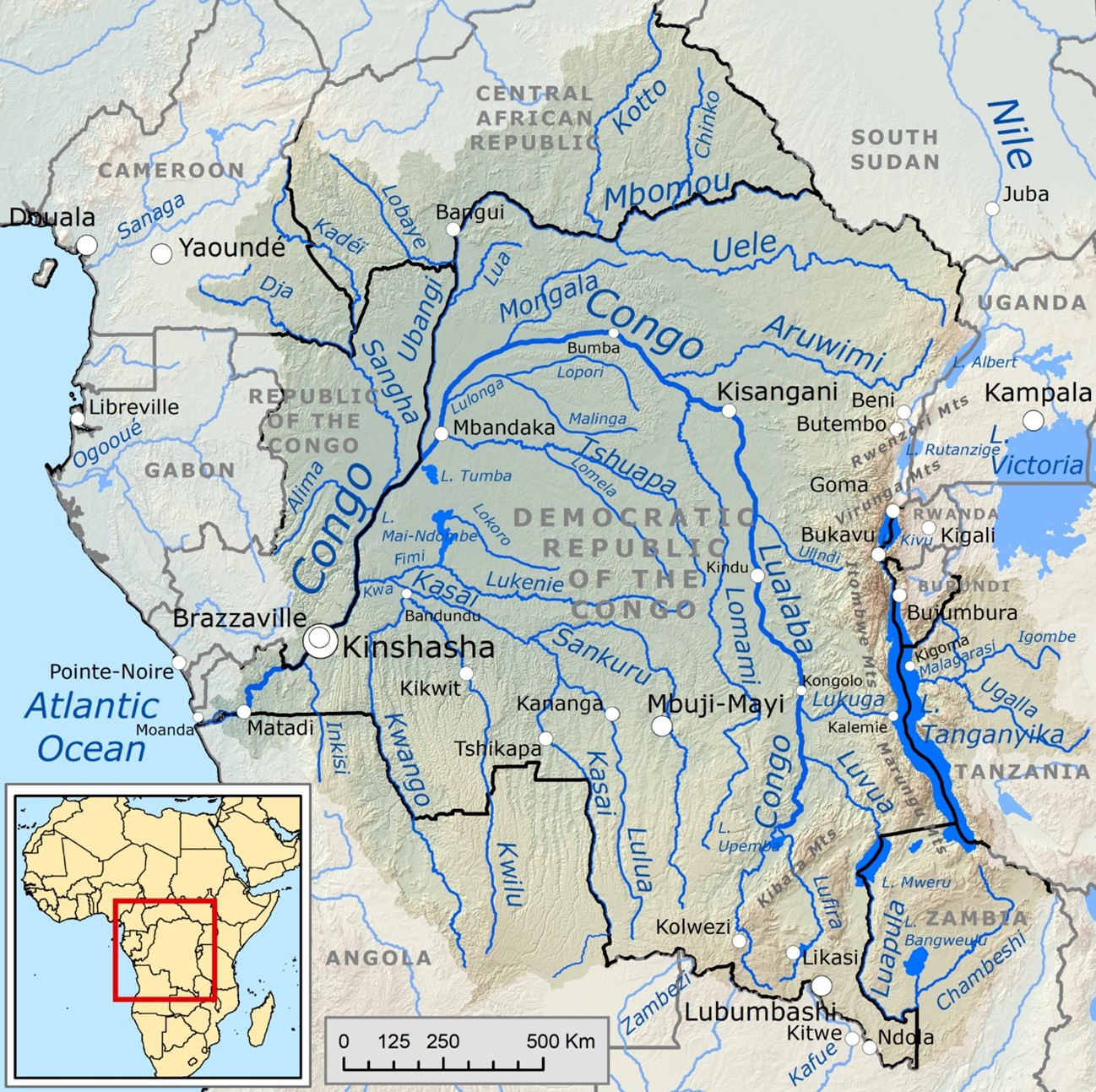
70% of the population is concentrated into urban areas along the Atlantic coast., whilst the rainforests and jungle of the north western region is largely uninhabited. The Congo River’s drainage basin covers 4,014,500 km2 The Congo River flows along the eastern border with country’s border with the Democratic Republic of Congo and where it enters the Atlantic at the southern border of the country with that of Angola. The Congo is the second longest river in Africa and the second largest discharge volume in the world.
The size of the river and the silt loadings including pollution coming from out of country mining is noticeable in both its impacts to water quality of the estuary and the ocean into which it flows is substantial. Silt deposition around much of the coastline of West Africa both north and south of its inflow into the Atlantic, where the other silts make up a major food resource for phytoplankton and other sea life.
Democratic Republic of Congo.
The DRC is a poor country with a plan for a great new railway network. This is to be paid for by the handing over of large tracts of land to Chinese mining companies. The country is dissected by the Congo River and much of the country is drained by it and its tributaries. It is one of the poorest countries on earth with many people succumbing to water borne diseases such as cholera. The nation is the possessor of water riches. It has reserves of water greater than any other country in Africa.
Mining and minerals are a major source if funding for the country with large known reserves of copper, uranium and other high value commodities including Diamonds. The government has regular spats with independent mining companies who do not comply with the wishes of individual ministries.
The majority of the population has been urbanised with agriculture being a minor occupation. Historically important occupations such as rubber tapping is still carried out on a small scale. The creation of the nation via the use of commercial imperialism in the 1880s has had a lasting effect that has left the country unstable politically and economically, civil servants are the most secure employees nationally.
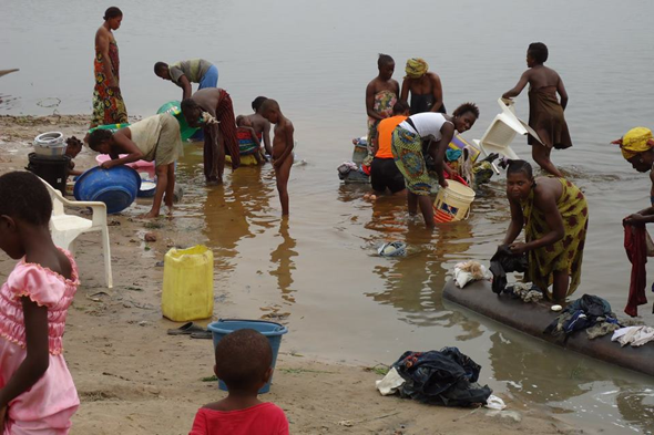
The nation is drained by the Congo River basin which flows with its tributaries throughout the nation. The River Nile acts as its border on its eastern edge with both Uganda and Tanzania. River pollution is common from mining operations, but human effects are more problematic with over 75% of the population having no access to reasonably clean drinking water.
South Sudan.
South Sudan is set on the River Nile, one of the planets youngest nations, and a product of a bloody civil war. Since the (2013) the country has suffered inter tribal conflicts and inserection which the government is attempting to bring to an end.
‘The main priorities of the government are to address the underlying causes of the conflict and to stabilize the economy. Going forward, strengthening service delivery institutions, governance, and economic and public financial management systems will prove critical as the country seeks to build resilience to future shocks, providing building blocks for a diversified, inclusive, and sustainable growth path. As the economy recovers from multiple shocks, sustaining the momentum into the medium-term will also crucially depend on the government’s ability to stimulate the creation of a sufficient number of quality jobs to absorb a young and expanding labor force.’ (World Bank, 2022)
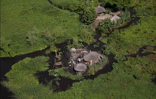
The country is the location of one of the largest floating and terrestrial wetlands on the planet, the Sudd. This vast area of wetland gained its name from the Arabic sadd (سد), barrier. The floating marsh blocks the White Nile to any navigation. From the Romans who wished to use the Nile to conquer lands south of the Sudan were unable to travel any further. Similarly Victorian explorers were held at this point in their search for the source of the White Nile, eventually such exploration had to be carried out from the central east coast of Africa.
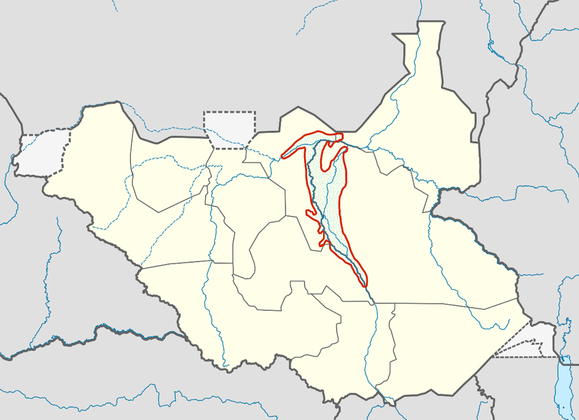
Prior to the civil war the Sudanese government had started to encourage the construction of a canal through the main swamp to allow oil exploration in the region. The South Sudan government are looking to rekindle the project to bring in oil revenues to drive economic development across the country.
Eritrea.
The north-eastern area that was a state of Ethiopia, is now an independent nation. The region prior to independence was the location of a great drought that gave rise to Band Aid and Comic Relief charities and events of the 1980s. Water still is scarce as violence and unrest are common, if not due to civil war there are border conflicts with Ethiopia, which is itself relatively unstable.
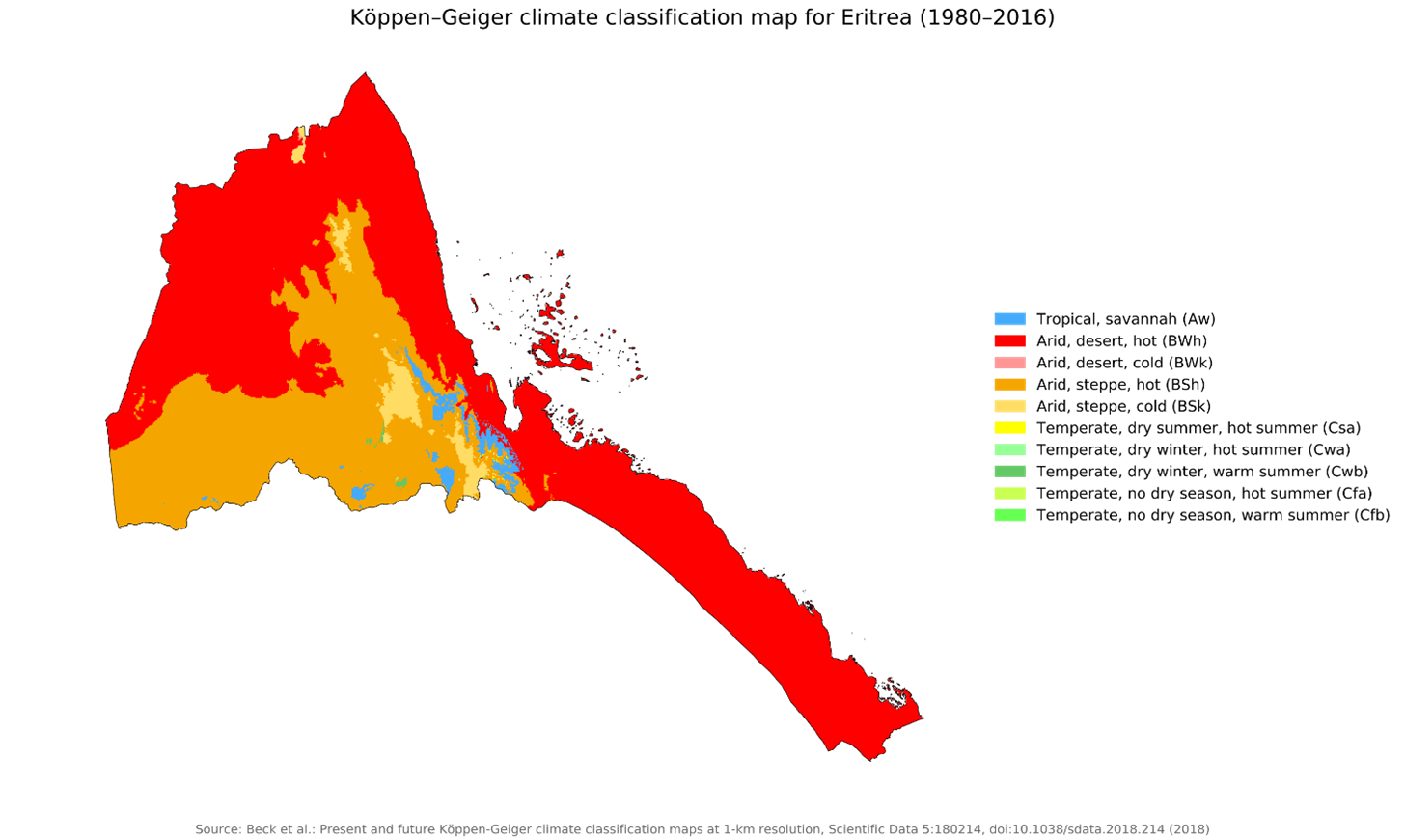
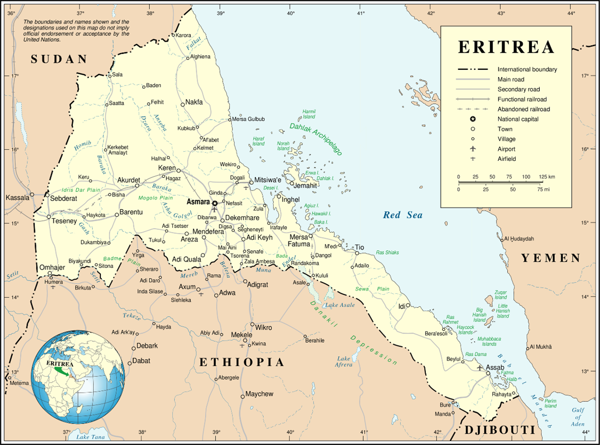
Apart from the main part of the country the nation includes 350 islands. The majority of the country is arid, agriculture is mainly subsistence and pastoralist in nature. The majority of the population is malnourished, poor and lacks medicine if not medical expertise.
There are 15 rivers, they are mainly seasonal, reliant on the monsoons to put water in them to flow. Most are turbulent in nature and only flow for a few hours at a time. Some of the rivers though are permanent (4 in number) such as the Tekezé River which flows out of the highlands of Ethiopia. All the rivers are being planned by the government to be used for power generation and resources for irrigation of larger farming enterprise. There are hopes to grow cash crops to help fund the nation develop faster. Many such crops though are not food, roses being a high value commodity easily flown to the international market in the Netherlands.
One crop that water is found for is Catha edulis or qat which is grown for local use as well as for export to Somalia and Yemen. The government is trying to ban both its growth or use, but to little success.
Belize.
Belize is a small nation set within the isthmus that links both North and South America. It is supplied with water and sewage services by a privitised company, Belize Water Services with the government holding around 83% of the shares and other agencies, 7% the state social security board, hold another 3%. The rest are held by private investors. This model works well and allows for institutional borrowing to upgrade infrastructure.
The country is unusual in that it has high quality water reserves of ground and surface water, a tropical rainfall pattern that ensures aquifers and surface water supplies are more than adequate. There is though no ful understanding of the resource at present and research is now starting to get a better understanding of the present situation. The nations population is growing, the per capeta daily water usage is seen as close to European usage at around 200 litres per day.There has also been a marked increase in agricultural usage of water that is at present under regulated.
Due to the country’s location in the tropics sewer and storm water floods are not unusual during the wettest periods. Much infrastructural development has been put in place over recent years to alleviate the problems.
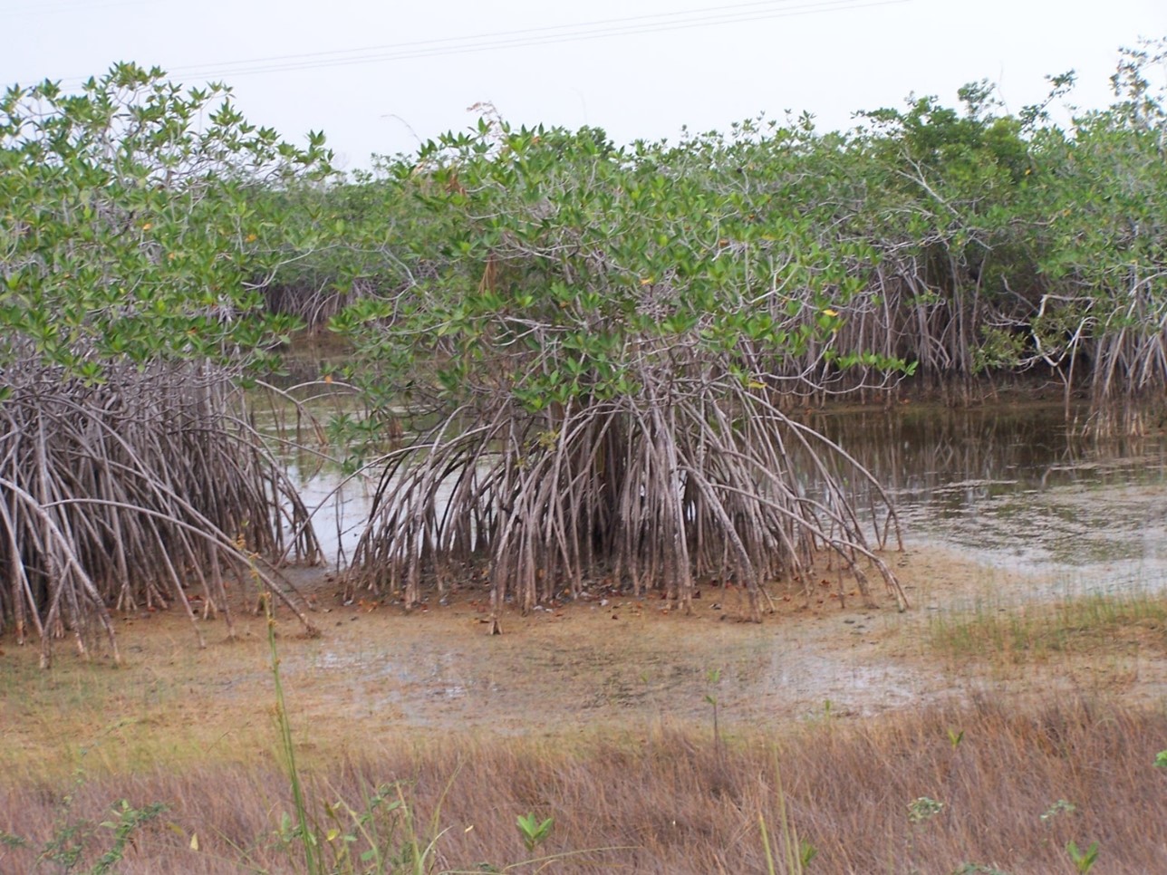
Though Belize has an environment protection agency the water company is seen as a stronger agent of environmental care due to its wish to protect its water assets and protect the coastal fringes from tidal and storm surge flood inundation. The company is highly protective of the coastal mangrove swamps.
Some isolated water communities are not so fortunate with drinking water quality due to lax waste water practises, though these are becoming far less common due to public health initiatives at regional as well as national level.
The mangrove wtlands along the coat of the country are found also to grow further off shore as wel, along parts of the Belize Barrier Reef where a significant population of West Indian Manatee are located.
The nation is developing eco tourism as it has one of the most diverse mixes of biodiversity in the America, plants, mammals, birds; all are relatively easy to encounter with ease.
Guatemala.
Guatemala is a country still recoving from its 36 year long civil war which ended in 1996. The economic destruction and civil life is still plain to see after so long. Malnutrition, poor health and poverty are evident everywhere and the poor state of both public water supply and the prevalence of pollution of rivers is equally prevalent.
Many rivers in the country are used as waste depositories, huge volumes of plastics flow out to the ocean via these conduits. The government have sadly not been able to stop this waste from entering the rivers but is engaging the populations to net rivers to catch the waste so it can be either recycled or at least go to landfill. The scheme is though prone to mismanagement with reports that much of the waste is reentering the rivers rather than going to landfill.
The issues of waste are complex in parts of the country due to the nation being devided by criminal gangs and cartels that monetarise evey aspect of society. Waste appears to be an area away from the drug industry that is becoming increasingly valuable. At this stage in their involvement poor practise is the most profitable. Into the future it is likely best practise might become the most lucrative.
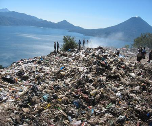
The problems of waste such as plastics is that a nation needs a sophisticated and integrated handling system of recycling and manufacture to create a circular economy. In a poor nation such as this the making of money quickly is all that is important. The creation of industry that uses product from recycled waste streams is initially expensive and such investment is at a nation such as this difficult to justify instead of taking profit.
French Guiana.
French Guiana is a part of France and as such part of the European Union. It receives funding for environment improvements much the same as an arrondissement of Paris. 97% of its land is made up of forest, much of which is tropical in nature. The French region’s population is just under 300,000 people almost triple what it was in 1990. Industry which historically had been based round forest products is now regulated though hunting of wildlife is not regulated satisfactorily at present, many species are illegally exported across the globe. The department started life as a convict settlement area for the survivers of the prison on Devils Island during the 19th Centruy when nearly 60,000 convicts were transported to the region. Only around 10% survived their incarceration.
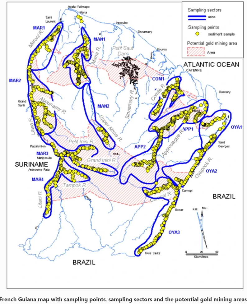
The main sources of river pollution are gold mines set up illegally, miners coming into the region across the borders with Suriname and Brazil. Little is reported by the Gendarmerie of their travails in countering of these invasions.
1330 km of waterways have been damaged by mercury used to extract gold from the mined rock. This pollution is a danger to people but the endemic wildlife of the forest.
Suriname.
Suriname It has a population of approximately 575,990, dominated by descendants from (slave) laborers brought in from Africa and Asia by the Dutch Empire and Republic. Most of the people live by the country’s (north) coast, in and around its capital and largest city, Paramaribo. It is also one of the least densely populated countries on Earth.
Situated slightly north of the equator, Suriname is a tropical country dominated by rainforests. Its extensive tree cover is vital to the country’s efforts to mitigate climate change and maintain carbon negativity. A developing country with a relatively high level of human development, Suriname’s economy is heavily dependent on its abundant natural resources, namely bauxite, gold, petroleum and agricultural products.
Due to the variety of habitats and temperatures, biodiversity in Suriname is considered high. In October 2013, 16 international scientists researching the ecosystems during a three-week expedition in Suriname’s Upper Palumeu River Watershed catalogued 1,378 species and found 60—including six frogs, one snake, and 11 fish—that may be previously unknown species. According to the environmental non-profit Conservation International, which funded the expedition, Suriname’s ample supply of fresh water is vital to the biodiversity and healthy ecosystems of the region.
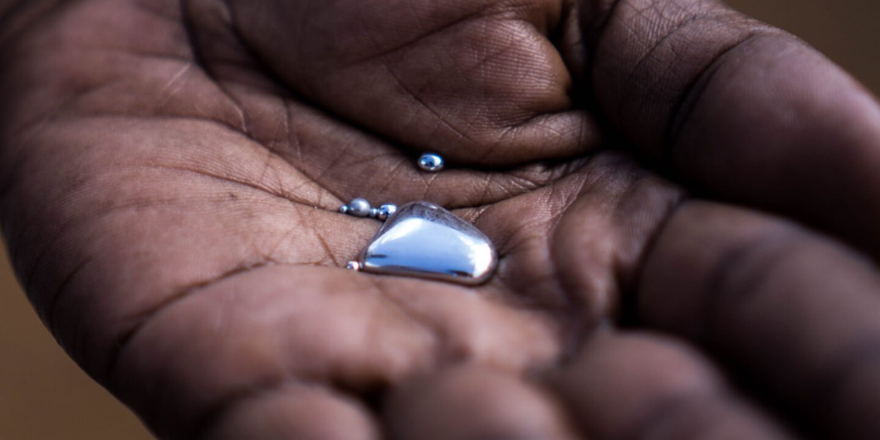
It is the volume of water that minimises to some extent the effects of poor mining practice, particularly in the winning of gold. The main pollutant being mercury which has been found in water supplies and food stuffs.
Bhutan.
Bhutan is an isolated nation of the Himalayas. It is ruled by its king who limits the number of visitors allowed into the country. Plastic bags are banned.
The kingdom has a near pristine environment with little water pollution and no scarcity, but its population has grown markedly. This has led to humans encroaching on what were wildlife habitats by agriculture. The government is investing in solar powered alarms so that damaging wildlife may be shooed away from crops.
It is questionable ethically that the indigenous population are shielded from much that is going on in the world.
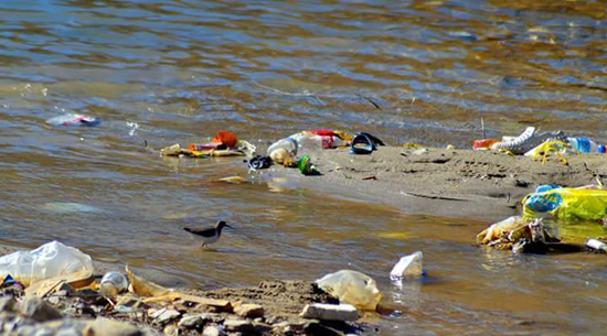
Regarding pollution, the country is the only carbon negative nation, but plastic get everywhere even Bhutan as here on an otherwise clean river along way from an urban centre, all of which are down stream of here.
North Korea.
North Korea is a problematic nation on which to report on, particularly regarding anything as negative as water pollution.
Article 173 of North Korea’s Penal Code stipulates that a person who pollutes air, water, or soil in violation of the Environmental Protection Order shall be sentenced to forced labor for up to one year. If the violation is more serious, then the sentence will be up to three years at a forced labor facility. This ensures that rivers are not the depositories for individual’s wastes but the state owns industry. Industry is the major polluter of the nations rivers, from tanneries to iron and steel works, mines and armaments.
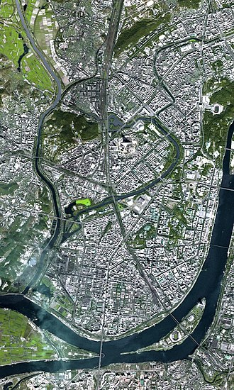
The Potong River flows through the capital and has been a traditional place to congregate for rallies of support for the nation’s leader. This has recently changed as it has been made an offence to meet on its banks due to fumes.
The river is due to be cleansed, the smell and danger to citizens of the city who have been told that industry is going to install state of the art treatments. One ambition is for the river to become a venue for all year round swimming.
Papua New Guinea.
Papua New Guinea was the location of one of the worst mining pollutions of all time . It was called The OK Teddy Mine Event.
The Ok Tedi environmental disaster caused severe harm to the environment along 1,000 km (620 mi) of the Ok Tedi River and the Fly River in the Western Province of Papua New Guinea between around 1984 and 2013. The lives of 50,000 people have been disrupted. One of the worst environmental disasters caused by humans, it is a consequence of the discharge of about two billion tons of untreated mining waste into the Ok Tedi from the Ok Tedi Mine, an open pit mine situated in the province.
This mining pollution, caused by the collapse of the Ok Tedi tailings dam system in 1984 and the consequent switch to riverine disposal (disposal of tailings directly into the river) for several decades, was the subject of class action litigation brought by local landowners naming Ok Tedi Mining and BHP Billiton. Villagers downstream from Ok Tedi in the Fly River system in the Middle Fly District and the southern and central areas of the North Fly District in particular believe that the effect on their livelihood from this disaster far outweighs the benefits they have received from the mine’s presence in their area.
In 1999, BHP reported that 90 million tons of mine waste was annually discharged into the river for more than ten years and destroyed downstream villages, agriculture and fisheries. Mine wastes were deposited along 1,000 km (620 mi) of the Ok Tedi and the Fly River below its confluence with the Ok Tedi, and over an area of 100 km2 (39 sq mi). BHP’s CEO, Paul Anderson, said that the Ok Tedi Mine was “not compatible with our environmental values and the company should never have become involved.” As of 2006, mine operators continued to discharge 80 million tons of tailings, overburden, and mine-induced erosion into the river system each year. About 1,588 km2 (613 sq mi) of forest has died or is under stress. As many as 3,000 km2 (1,200 sq mi) may eventually be harmed, an area equal to the U.S. state of Rhode Island or the Danish island of Funen.
Following heavy rainfall, mine tailings are swept into the surrounding rainforest, swamps, and creeks, and have left behind 30 km2 of dead forest. Thick gray sludge from the mine is visible throughout the Fly River system, although its effects downriver are not as severe. Chemicals from the tailings killed or contaminated fish, although they are still eaten by the people of the surrounding villages. However, fish counts decrease closer to the mine. The massive amount of mine-derived waste dumped into the river exceeded its carrying capacity. This dumping resulted in the river bed being raised by 10 m, causing a relatively deep and slow river to become shallower and develop rapids, thereby disrupting indigenous transportation routes. Flooding, caused by the raised riverbed, left a thick layer of contaminated mud on the flood plain among plantations of taro, bananas, and sago palm that are the staples of the local diet. About 1300 km2 were damaged in this way. The concentration of copper in the water is about 30 times above the standard level, but it is below the World Health Organization standards.
The original plans included an Environmental Impact Statement that required a tailings dam be built. This would allow heavy metals and solid particles to settle, before releasing the less polluted ‘high-water’ into the river system where remaining contaminants would be diluted. In 1984 an earthquake caused the half-built dam to collapse. The company continued operations without the dam, initially because BHP argued that it would be too expensive to rebuild it. Subsequently, the Government of Papua New Guinea decided a dam was not necessary, in the wake of the closure of the Panguna mine.
Most of Papua New Guinea’s land is held under a system of native title, with ownership divided amongst many small clans, while the central government retains control over how resources that lie under the ground are used.
There are no waste retention facilities on the premises. This allowed all ore processing residues, waste rock, and overburden to be discharged into the Ok Tedi River.
In the 1990s the communities of the lower Fly Region, including the Yonggom people, sued BHP and received US$28.6 million in an out-of-court settlement, which was the culmination of an enormous public-relations campaign against the company by environmental groups. As part of the settlement, a (limited) dredging operation was put in place and efforts were made to rehabilitate the site around the mine. However the mine is still in operation and waste continues to flow into the river system. BHP was granted legal indemnity from future mine related damages.
The Ok Tedi Mine was scheduled to close in 2013. However, the PNG Government has taken over control of the mine and with support of local community, the mine life was extende. Until the future closure, two thirds of the profits are to go into a long-term fund to enable the mine to continue to contribute to the PNG economy for up to half a century after it closes. The balance is allocated to current development programs in the local area (Western Province) and PNG more generally. Experts have predicted that it will take 300 years to clean up the toxic contamination.
Bibliography.
https://en.wikipedia.org/wiki/Lake_R%27Kiz
https://www.irn.org/files/en/africa/africa-other-projects.html
https://www.wearewater.org/en/mithi-river-the-pollution-of-poverty_340931
https://www.britannica.com/place/Central-African-Republic/The-colonial-era
https://www.oecd.org/countries/equatorialguinea/1824667.pdf
https://www.opec.org/opec_web/en/about_us/4319.htm
https://www.icj-cij.org/en/case/179
https://www.unep.org/resources/report/river-partners-democratic-republic-congo
https://www.worldwildlife.org/places/congo-basin
https://www.sanitationandwaterforall.org/partners/countries-map/republic-congo
https://borgenproject.org/water-quality-in-the-democratic-republic-of-the-congo/
https://www.worldbank.org/en/country/southsudan/overview
https://www.amusingplanet.com/2012/08/the-impenetrable-wetland-of-sudd-in.html
https://www.sciencedirect.com/topics/immunology-and-microbiology/catha-edulis