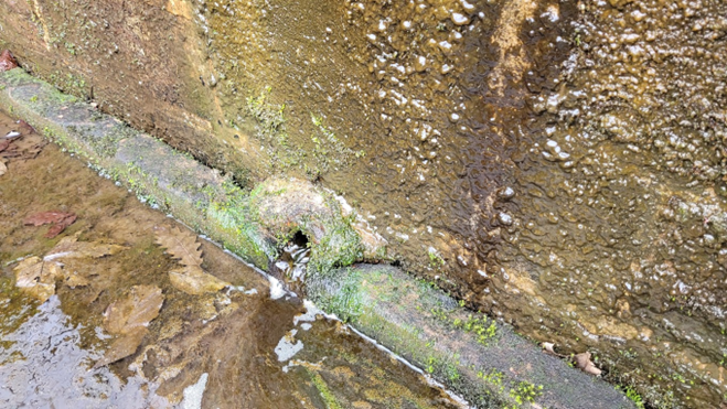
The Source of the River Trent on Biddulph Moor a few miles north and east of Stoke on Trent.
Introduction.
It is too often flooding in the middle and lower stretches of rivers that make people aware of the issue. The initial stages of rivers are smaller, tributaries are smaller, and the rivers do not look as if they could cause problems. But this is where the problems start and similarly the tributaries. Floods start in the higher ground, at the sources of rivers. The little and fledgling rivers as they start to flow to the sea are developing their nature and propensity to flood.
All rivers flood to a greater or lesser degree, it is all dependent on their geomorphology and the weather. A river in a desert may flood after the first rainstorm in years, the water being channelled into wadi valleys that are just not equipped to manage sudden torrents of water and mud that has been developed as the dry surfaces are liquified by the nature of the raindrops that form the precipitation. Other rivers may flood due to snow melting quickly in the mountains if the weather in spring is unusually warm. Others will flood if their headwaters suffer from protracted periods of rainfall in their upper reaches or their whole catchments.
For the purpose of this exercise, we have taken one river catchment that is renowned for its propensity to flood, the River Trent. The river is in the centre of England and drains much of the Midlands out into the Humber Estuary. It is the third longest river in Britain and has one of the broadest floodplains in Europe. It is both a lowland drain taking water from the relatively flat counties of Leicestershire and Lincolnshire as well as taking the drainage from the southern high ground of the Pennines, draining Staffordshire, Derbyshire and Nottinghamshire. It is unusual in that it has many of its major urban centres located in its upper reaches. This being due to the early development of metal trades and waterpower which was later replaced during the Industrial Revolution of the 18th and 19th centuries by the abundant coal from the coal measures that underly much of the region.
The river and its tributaries do not just carry the water that comes naturally from the ground and flows to the sea. It takes the wastewater that industry and a population of around 5 million discharge to sewage treatment, much of which is taken from the catchment groundwater which will lower the natural flow of the water. The water supply though for Birmingham comes from outside the catchment and comes from Wales. This supply can add markedly to the volume of surface water, and natural river flow at times of high river flow.
The River Trent has always been a river of flood which can change its main course swiftly. The river has constantly changed, the plan of the paleochannels around Newark on Trent demonstrate this and in more recent times such flooding and course change has been reported in Shakespeare’s Henry IV. Later, the river during the 3rd siege of Newark, 1645-56, is known to have made attack and defence difficult with not just the land along the Trent inundated but pontoons and other bridges across the area destroyed by ice flowing down the river. Similar destruction of bridges took place in the 18th century at Nottingham and Newark. It was in the same century that there was rivalry between Nottingham traders and those of Newark which came eventually to a head with regard to which borough was the most sensible for the main road from London to Scotland. It had since Roman times been that of the Great North Road passing through Newark. This was a hugely valuable coaching route and linked to the Trent as a major navigation. In the winters though the river flooded across the Newark washlands and island, cutting across the Great North Road. This cutting off of the route encouraged the Nottingham Corporation to draw the trade to their city and away from the traditional route. The route was though secured by the Newark Corporation who engaged John Smeeton, the first civil engineer, to design and build two miles of causeway between Newark’s castle across the river to the bridge a Muskham. Though the Great North Road (A1) now bypasses Newark, the arches still carry a major road along their length today.
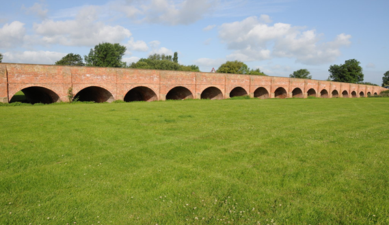
Bridges over the river are historically few due to edicts and laws first brought into play by Edward the Confessor which stopped all but the most necessary bridges being built so as not to impede the river navigation. Any crossing of the Trent up till recent times required a local Act of Parliament to be enacted due to the importance of free passage of goods up and down stream.
The lands above and below Newark flood regularly, and over the last twenty-five years more regularly than it did in the previous hundred.

The river system that drains much of the English Midlands and South Pennines.
Images and Maps of the Area Relating to Flooding on the River Trent.

The infrastructure that influences the river system.

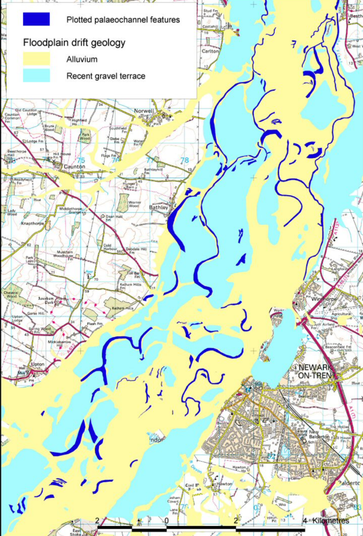
Newark on Trent paleochannels demonstrate the complexity of water movement through a river valley. Much water passing beneath ground surface even before the water appears to flood. Complex sets of lost river channels may be expected to run alongside the river itself from around Stone to the just south of the river’s confluence with the Humber Estuary at Trent Falls. This being illustrated by the plan above and that of the survey area below.

The areas along the Trent and tributaries that have been studied to see the historic changes in the river’s course. The palaeochannels still move groundwater through the gravels and alluvium and cause floods without the main river overtopping. This being notable in 2024 where new housing south of Newark was found to be built in a marsh, and a forced drainage scheme need to be put in place to allow these properties to function
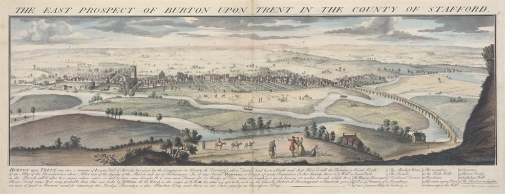
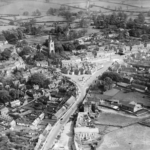
The River Trent at Burton in 1732 demonstrates the need for a causeway across the river floodplain with a wooden causeway visible on the left-hand side of the image. The multi-channel make of the river at this point demonstrates how the river flowed before the main flood banks were put along its banks in the late 1940s and 1950s.
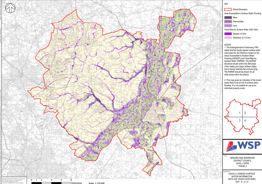
The Flood Plan of the area through Newark and Sherwood District Council’s area demonstrates close links to the surveyed paleochannels. The small-scale tributaries are also prone to flood moderately due to the lack of available volume in the main river.
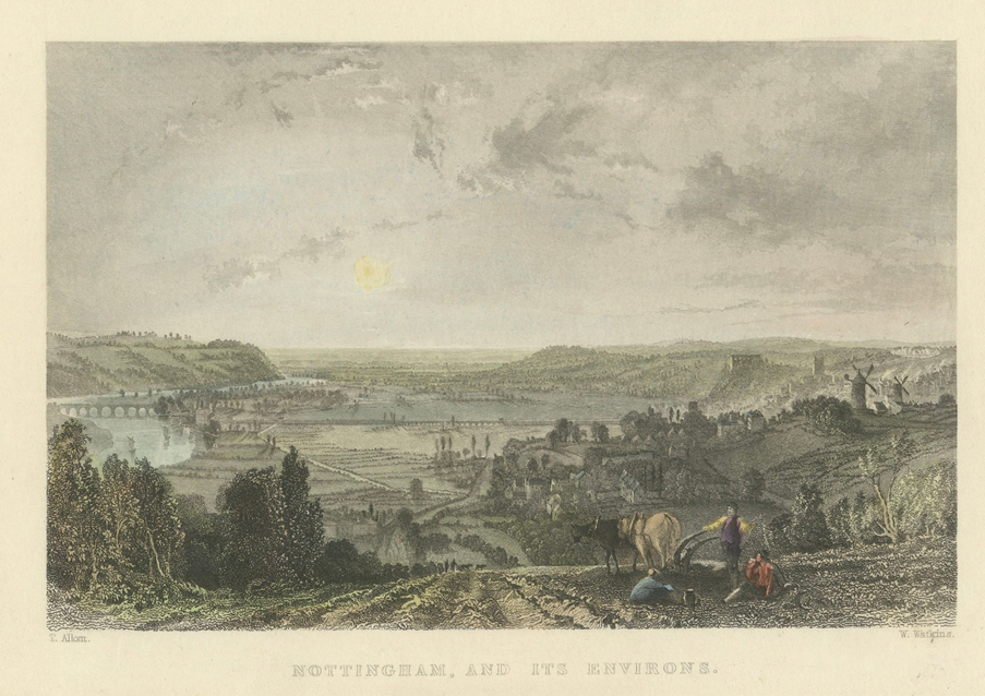
The River Trent flowing on the left of the picture and the causeways across the floodplain to Nottingham. The floodplain is partially flooded in the Crocus Fields area and Broadmarsh. 1837.
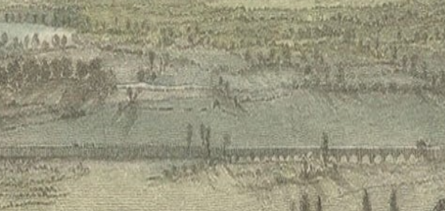
Detail of the flooded area below Nottingham and the causeway being used.
Solutions to Hold Back the Flood.
The only way to tackle a flood problem on a river such as the Trent is to hold back water where it first enters the catchment. This also allows for better water quality flowing throughout the catchment. At present the Environment Agency and the Government split the River Trent into sections. The Erewash and Trent to the Humber Estuary and Upstream From Burton on Trent. Such a move as to hold back the flood will require a whole catchment strategy, many people will need to be involved and to agree to a lot of land being repurposed. Every tributary and stream in catchment area might need to be assessed to see if they are suitable to hold back water, their surrounding land might be turned to wetland or suitable to be turned to water meadow. Would leaky dams hold back enough water to hold back enough water? Would a major realignment of rivers and streams work.? The answer in most cases is yes but it requires a change in attitude and until such answers are put in place flooding will continue.

Marked wetland and other water holding device locations on the plan above are approximate. The number of sites would likely be greater, and their sizes would vary.
The creation of such infrastructure will have major positive benefits, increases in habitat and biodiversity. Capture run off from agricultural and roads. The wetlands would also sequester atmospheric pollutions and function as carbon sinks on a massive scale.
Costs of such schemes are large but are now more acceptable to farmers and landowners. There are already moves to create wetlands along the Trent, Tame, Anchor and other rivers. The move to capture carbon from the industrial conurbation of Birmingham and the Black Country is also a source of support. Many might suggest the introduction of beavers to a number of areas but as these creatures are expensive and their reintroductions are projects in themselves.
Alongside these wetland sites the region’s wastewater treatments works may use tertiary treatment wetlands to bring their discharges up to a higher quality. Thus, start to break the traditional cycle of considering that discharges from sewage works and industry could use the river flow volume to dilute their polluted waste streams. Alongside wastewater the runoff from motorways and major roads impacts the river water quality.