The River Trent; an Introduction.
The River Trent has been at the centre of my world for more than thirty of my fifty-nine years. It has been an odd relationship, starting as a child visiting to picnic and walk beside it with my parents, and latter in life having to research its ills and understand the various uses this waterway has had and its roles today. It is this period of study that has allowed a fuller understanding of its importance to so many people.
The third longest river in Great Britain and the least known, as rivers go it has a great deal going for it, though not the great and good to laud or praise it; not many great family estates border its banks, no picturesque mountains to cascade from: it is a Midlands river that has not drawn artists to its banks like some, the Wye or Thames. It is a working river, giving of itself incessantly; its uses have made many rich through navigation and the movement of manufacture, minerals and agricultural produce. The production of power from its unceasing and cooling waters continues to contribute to industry and wealth creation today.
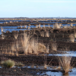
The source of the River Trent; Trent Head on Biddulph Moor, Staffordshire.
People are rediscovering the river, there are more people today involved with it than at its busiest period during the 19th Century. This new interest has mirrored that of the water’s quality. As the river has become less polluted more people want to connect visually or physically with it. Water skiing, rambling along the bank side towpaths; bird watching, pleasure boating, canoeing and sailing are all popular activities.
Fishermen and anglers have been involved with the river from time immemorial aware of changing water quality; dead fish or lack of them, foam, changing colour, fluctuations of temperature and the appearances of exotic species of aquatic life. Due to its size and volume of flow the dilution of pollutants was marked, the rivers power stations warmed the waters and the river was an active match fishing destination for anglers’ right through the last quarter of the twentieth century. During the coldest period of the year the river continued to allow large catches of a mixed bag of fish and match fishermen came from Yorkshire and Lancashire to enjoy their sport. As with the Trent; their home rivers are now of a far better quality and hold good fish stocks so the Trent has lost many hundreds of fishermen from its banks. The fish stock has also changed; many more large specimens and the small younger stocks are more elusive due to greater water clarity. The Trent never stops changing.
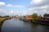 Gainsborough River Frontage.
This country’s towns and cities have up till the 1970s and 80s been either unconscious of or disinterested in their rivers or river frontages, this changed with the fashionable redevelopment of the London Docklands. This gentrification spread rapidly changing Trent side towns, Burton, Newark and Gainsborough now have fashionable residential areas converted from riverside industrial premises and warehouses, Nottingham has a riverside football ground, upmarket shops and bars on the canal side that took the Trent Navigation up to the Lace Market. Parks and riverside walks border the river by County Hall. It takes Stoke on Trent to demonstrate the historic disregard that was in the past a rivers lot. The Trent disappears into culverts and reappears choked with plastic and detritus of all sorts. Here it is a small river that gave the potteries power to mill its raw materials and gave its waters to the transport of its wares to the world’s markets. Now it flow nearly unnoticed through a city that bears its name.
 The River Passing Through Stoke on Trent.
The river is known to trespass; over the centuries it has been channelled and dredged but it regularly escapes in flood. Historically the Trent was a broader stream, sluggish, depositing silts and cutting new channels. Ox bow lakes are a common vestigial reminder of these events. Some changes in course were more dramatic; Shakespeare noted; a large tract of land cut off from its owner by the river changing its route near Burton on Trent (Henry IV part 1).
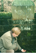
At North Collingham, downstream of Newark, the churchyard wall is marked with the water levels of floods from the eighteenth century to the present. Further down stream the villager of Girton refused flood defences in the 1950s, preferring the views across the washlands; since then several floods have occurred and opinions have changed.
Water quality of the River Trent has improved markedly over the last twenty odd years; its use as drinking water was for a long time only a pipedream, now though a reality with abstracted water taken from the river and stored in disused sand and gravel quarries on the Nottinghamshire Derbyshire border near Shardlow. It is said that river water quality is now better than at any time since industrial development began.
The crossing of the River Trent has always been an issue travellers heading north or south, the Romans during their invasion of the Britain had to stop at the Trent to regroup and consolidate their position before venturing across the valley to take possession of the North of England. This gives some idea of the river and its valleys geographic dominance of the surrounding country at the time. Similarly at Swarkestone Bridge Charles Edward Stuart and his army terminated their march south towards London during the 1745 Jacobite Uprising. The geography of the river and its broad valley unsettled the Highlanders who felt uneasy campaigning in a wide, open landscape.

Swarkestone Bridge
Bridges have never been common crossings the River Trent, ferries being the most favoured and to a lesser extent fords, particularly upstream beyond Burton. Bridges being expensive to build and maintain; there are several instances of them being washed away in floods. All crossings of the river required Parliamentary Bills to be enacted, which further added to the price and only a few individuals; at Shugborough and Swarkestone, and town and city corporations could afford such schemes. There is one toll crossing left operating under Parliamentary Statute at Dunham Bridge between Newark and Gainsborough. The ferries have all ceased, most during World War II and the majority of Local Crossing Acts were repealed during the 1990s. Two major causeways exist on the River, as part of the extended Swarkestone Bridge which was built over several centuries and the one over washlands carrying the Great North Road between Newark and South Muskham designed by John Smeaton in the Eighteenth Century.
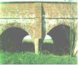
Smeaton’s Newark Causeways Runs for nearly Two Miles.
The river was granted the status of being Royal in 1064, one of the four; Thames, Severn and Yorkshire Ouse being the others, by King Canute. This gave certain protections to all class and type of person engaged in trade or otherwise reliant upon the rivers. Bridges were not to obstruct boat navigation, fish weirs likewise and navigation should not endanger crossings, nor mills hold back the flow. In 1698 there was the first Trent Navigation Act that allowed dredging and other works to be carried out to improve navigation and begin the general shaping of the river’s course as seen today between Burton and Nottingham. Earlier in the same century King Charles I retained the Netherlander Vermuyden to drain the moors between the Trent and the course of the old River Don around the Isle of Axholme and Trent Falls; where the rivers Don, Ouse and Trent make up the Humber Estuary. This drainage work coursed much upset with the marsh dwellers that lived in intimate closeness with the river; wildfowling and fishing being the locals’ main employment. The draining of these fens led to insurrection and a low-key civil war that carried on throughout the English Civil War, the Commonwealth and into the early years of the reign of Charles II. The |last Trent Navigation Act gained Parliamentary approval in 1906.
The river has been a power house for the local communities ranged along its banks for many hundreds of years and for England during the last half of the Twentieth Century, The Trent gave its waters to turn many watermills to grind both foodstuffs and raw materials for industry. Between the 1940s and 1999 there were up to ten functioning electricity generating power stations operational at one time, producing when required one third of the national power requirement. The river runs through many coal fields so fuel was abundant and easily transported to the power stations and the river provided the cooling water that these stations required. Today there are still four stations operational and burning coal, which is mostly imported, and one gas powered at Staythorpe out side Newark.