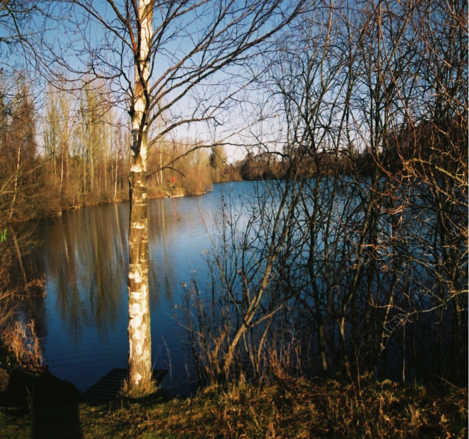
A View of the Lake.
Introduction.
At the meeting held on 23rd January 2014 (present Councillor Keith Walker, Chair of Balderton Parish Council, Jim Brown of the Parish Council staff and Harvey Wood of CRT) at the lake discussion took place which concluded that the research the Parish Council had planned to commission should go ahead as desired but that CRT would also put forward its views and recommendations for the lake to increase its long-term sustainable development as a fishery and wild life habitat whilst accepting its other roles within the community including a backdrop to dog walking, site for feeding the ducks by both adults and children, bird watching, photography and other activities. The Trust agreed to put forward its views within a few of weeks of the meeting.
The first; preliminary overview of the lake was given to the Parish Council at the meeting. The main findings were that the lake’s chemical water quality was good and that there were no issues regarding that but there appeared to be a lack of ‘life’ in the water body that would allow a sustainable development of the site into a naturally self-sustaining eco-system which is the desired outcome for this body of water. The water sample analysis corroborated and demonstrated this view.
At the meeting various methods for developing habitats and biodiversity were discussed and a report by the local sub aqua club, regarding the nature of the lake bed and its depths up to thirty feet from the bank was passed on for the information of the Trust. The issues perceived as of importance are outlined in this short report. The geology of the area and the hydrogeological basis of the lake are outlined as is the general makeup of the various fill materials that have been in the past used to make the final lake sides and bottom.
The lake was originally dug as gravel pit that supplied gravel ballast and sand used in the development of the area; the resultant voids were then used as a permitted landfill site that took a wide variety wastes, both domestic and commercial. The gravel extraction and landfill site was originally very much larger than the present lake site. The other areas that were completely in-filled and finally rehabilitated as housing developments. It was learn that one house close to the water had to sink supporting piles 15 metres below the surface of the land surface to ensure firm foundations for an extension to the property. (Conversation with the Parish Council representatives and CRT 23rd January 2014.) This is unlikely to have been due to the depth of the landfill but the underlying mudstones may have demonstrated an engineering weakness that required such piling to solid ground.
The Lake.
The body of water has been developed as a fishery since the redundant sand and gravel pit ceased being used as a landfill site in the mid-1970s. The lake was never designed as a fishery or had any other restoration plan developed for it. The ad-hoc nature of its abandonment resulting in the present form it is today. The present expanse of water being the remainder of a much larger void which has been filled by many years of waste deposition (1965-1974) and ensuing housing development.
The majority of the water entering the lake comes directly from the Trent gravels ground water, though there are three small drains that discharge into it on the eastern edge. The major flow though enters through the base of the lake and has been described as ‘fossil water’. The lake gravels were laid down at the time of the last ice age when the River Trent’s valley took on its present form; previously it had flowed through to the east discharging where now the River Witham meets the sea at Boston.
The lake bed is understood to be in hydraulic continuity with part a pre-glacial water channel (paleo channel) system that is still traceable by surface environmental markers that discharged to the pre- Devon river sub-catchment drainage system. This channel and the groundwater issuing from the gravel beds that surround the area give the majority of the flow water through the lake. The underlying strata being mudstones once known as Keuper marl which deny the water that is abundant in the Trent gravels greater depth (British Geological Survey 1914, The Water Supply of Nottinghamshire, Lamplugh HR): it is reported that most wells in the village of Balderton were sunk to 10-12 feet in depth, but ample supply was obtained at a depth of 6 feet.
The average useful depth of aggregate won in the Balderton area was between twelve and fifteen feet, with an overburden of no more than one foot, this is demonstrated by the small topsoil bund at the north eastern extremity of the present lake. These figures would suggest that the depth of water within the void would be a maximum of 16 feet, but this is unlikely and with the added evidence of the lake floor report of 1992 by Newark Sub-Aqua Club it would appear to have a maximum depth of ten/twelve feet and less. The way by which the water body gained its final form was the operation of landfill management. The waste was filled into the void predominantly from the eastern and southern edges.
The landfill was operated by the local rural and urban district councils in the 1960s to take the growing domestic, commercial and industrial wastes from the area; the last industrial tipping apparently was carried out by the foundry company Worthington and Simpson in the early 1970 (EA) and comprised of much foundry waste including casting sands and waste metals including copper, bronze and other nonferrous metals (J. S. conversation January 2014).
The banks and land cover surrounding the lake are composed in large part by foundry waste which appears likely to also be the main constituent coating of the lake bottom (particularly fines). This layer is remarkable for its sterile nature and would seem devoid of any nutrient value. The grass and vegetation around the lake is growing but not thriving and the willows and other trees surrounding the water are species that can survive on little in the way of easily accessible nutrient. Tree planting has not been in many cases success full due to rabbits and other animals ‘barking’ the young trees, especially several holly trees only recently planted out.
The western edge of the lake is bounded by the old railway line from Newark to Market Harborough; beyond which is an industrial site that stockpiles calcined materials for manufacturing product. It was said on the visit to the lake that at times of dry weather, wind can whip up much of the mineral material and blow coarse dusts across the lake. This added ‘dressing’ of the lake water and sediments is unwanted and unnecessary.
The form of the lake; the banks and their steep nature have proven problematic for establishing wetland or reedbed margins, such plantings have only been partially successful with stands of reed (Phragmites australis) in two locations and a near total failure of setting a stand of ‘bull rush’ (Reed mace/Typha latifolia). There are few aquatic plants present, water cabbage, water lilies and a few others apparently dotted around; there is a one individual effort in hand to establish communities of flag iris and some floating and anchored weed species.
Opinion.
The lake is at this time well run though without some major investment in habitat creation and bank engineering the site will not develop as a sustainable fishery or wildlife habitat. The lake has been nurtured by the Parish Council and the Grove Angling Club with some individual members taking it upon themselves to invest much personal time and resource into improving the lake as an ecosystem and they can only be applauded for their efforts.
A lake in the ownership of the parish is a hard resource to manage to the liking of all the local residents who use the walks or fish about the lake. The path about the site is well used by the community and the fishing is enjoyed by both general anglers and match fishermen alike. The specialist carp anglers are restricted in the methods of ground baiting the swims they intend to fish with the banning or limitation of high protein bait and other substances. There are plain rules advertised as to what is not allowed to take place about the water, no boating or swimming, dog control and no alcoholic consumption, clear and concise.
The lake, as already stated is not a designed fishery or wildlife resource but a residual flooded hole in the ground and is being expected to act as a natural water body. As this is not the case the water body needs to be developed and formed into a sustainable water, such work is a more complex operation after so many years of developing as it has. The population of large fish are a resource that needs protection, but some considerable engineering might be envisaged as desirable. These actions will be outlined later in this document.
The water entering the lake is around 90% that coming from its base and sourced from the Trent gravels of the area, the rest being run off from the local area. The three dykes that bring water into the lake are of unknown source and quality (likely to be highly variable; there are anecdotes of oil staining from at least one of the entry points on its silts being cleaned from its exit point into the lake.
Past Research and/or Recommendations.
Newark Sub-Aqua Club.
At the meeting in January it was said that there were stories of some parts of the lake being very deep; this is despite the research carried out by the local sub aqua club that showed the form of much of the lake bed to be relatively shallow with a maximum of 12feet in depth. A sonar study of the lake will be arranged later in the year when a craft is available. The study by sonar would be used to map the bed of the lake in conjunction with the location of fish densities.
The report was very thorough and demonstrated the nature of the bed of the lake at the time (1992). It was useful also in underscoring the charicter of the lake and the narrowness of its shallow margins. It has been the basis of a graphic reinterpretation of the detail by Barry Mitchell.
Dr Bruno Broughton.
This report, by one of the pre-eminent fisheries authorities in the UK was detailed and comprehensive in its coverage of the issues arising in 1993 when it was completed. Many of his findings then are still relevant today.
New Future Report.
Balderton Parish Council has commissioned a report on the lake from consultants that will identify water quality issues, algal species and other aquatic material present within the lake.
CRT Actions Suggested for Discussion with all Stakeholders and Regulators.
The outline of possible actions outlined below might be considered singularly or in combinations with others.
Promontory/Reef Construction.
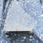
A simple method of developing large semi submerged areas of habitat for juvenile fish to find shelter and allow feeding development sites; the use of large blocks of concrete to be deposited from the shore into the water and allowed to find their own resting point. These structures to be built up so as to act as sites of algal growth and zoo plankton development.
The source of this material would be from local demolition sites. The need to stipulate the quality of this material would be important as other wastes imported without due care could bring about pollution of the lake water.
Some of the reef can be set above the lake’s water level and planted with reeds and other wetland plants that in time will develop hold on the promontories or reefs and develop lush herbage and root system growth into the lake.
Structure such as these can also be manufactured to bespoke design and have been constructed in the US, Middle and Far East.
Floating or Solid Islands.
The development of artificial islands either floating or based on structures fixed to the lake base. These structures have been used in the past on the lake but vandalism (cut loose, set fire to and/or sunk) has seen this practise cease. The member of staff of Balderton Parish Council is now of the opinion that the problem may not reappear due to the greater number of people who visit the area and have ‘ownership’ of the area.
Such structures have been found to be valuable to ecosystem creation in both the UK and US. Their design is crucial, they give more value to more species for the water area taken up by their form and can be protective of both juvenile fish as well as being developed as a feeding station that can become self-sustaining.
Placing wire cages beneath these islands allows fry to seek protection from predatory species of birds suck as cormorants or saw billed ducks which are commonly present on the lake. These cages are non-hazardous to the birds and at the same time aid island stability. Some artificial islands can, if the water is shallow enough, be placed directly on the bed of the lake. This requires sizeable rigid supports held together with a framework of wire than gives strength as well as forming refuges, the platforms can be of any size and shape but are usually rectangular wood wire and matting constructions lain over buoyant materials to allow the structures to be floated away from the shore for securing to the fixing points.
The structures within a couple of years lose their unnatural form, especially if these are large structures that might have sunken areas and high points with a well planted and diverse flora. Within two years rhizome root systems will start to grow away from the island and soften the form. The structures need to have a fertile growing medium held securely so as to allow a growth cycle to develop on them which lasts for a cycle of dieback and regeneration to become established. Islands need to have good fertility as the water body has little in the way of nutrient value for plant growth.
Fertilising the Water.
This is a popular method to increase fry development in some lakes in the United States where a liquid fertiliser has been added to lake waters. The purpose being to develop a community of algal growth and zoo plankton which is a cross section of essential fry food. This has been carried out in the UK but it has been reported anecdotally to give rise to blue green algal blooms; it is more common to use lime dosing of the water in the UK. This method has been used in the 1990s on the lake and has had no demonstrable long term benefit as a standalone option.
There is a role to play for these techniques; though not on their own and should be considered in conjunction with other options.
Juvenile Nursery.
The ideal nurseries for many species of juvenile fish are reedbeds where they can be found to feed in the flooded substrate of the marshland. In this habitat the young fish are free from many predators and algal growth is greater in the substrates of the wetland margins. These wetland areas could be developed at the eastern boundary of the lake; at the same time as being good for fry, ducks and other aquatic avian species would benefit and increase in numbers. This in turn pleasing the local bird watchers and others who gain pleasure from feeding them.
Beaches with Submerged Shallows
A similar method to submerged promontories that would require the creation of gentle sloping banks with gravel for several yards out into the water; this can be achieved by either putting ballast into the lake so creating a solid foundation overlaid by a clay/compost soil matrix that can be developed as a wetland/reedbed: this could also achieved by cutting sections of the bank back to 18 inches to 3 feet below the lakes water level and placing wetland plants in a gravel clay/compost soil medium. There may be issues regarding contamination and regulation if cutting into the bank was considered.
Wetland planting could be achieved at each angler’s peg which would increase the biodiversity of the areas around the whole water and would be a simple and inexpensive method of developing the bankside.
NOTES
1
Issues of Predation.
The development of a fishery will require a duty of care with regard to monitoring the lake and the management of some predators, scaring off, trapping others (i.e. mink) and with others other precautions might be necessary.
Mink.
There has been one report of a mink being seen in the area of the lake though no mink damage has been found. A ferret was reported around the same time as having escaped from its owner who lived locally.
In the pond north of the lake there is a good population of water voles which demonstrates a lack of mink in the area. Mink predate water voles and eliminate populations where ever they set up territories.
Cormorants.
A regular avian visitor on the lake, the water’s clear nature is a draw for these birds which fish by sight. They are a major problem for many fishery owners as they are gregarious both at their nest site and when feeding. They are protected under the Countryside and Wildlife Act but there are licensed culls allowed in certain specific circumstances. It is though questionable if such activities work, particularly in the long term. Such actions are also unpopular with many people who are more interested in birds than fish.
This sort of issue is particularly contentious for publicly owned waters such as the lake with the political ramifications needing detailed knowledge and still it becomes an issue of emotion and ‘gut’ reaction.
Otters.
Otters are at present not an issue at the lake though they have been seen on the river Devon, the eventual receiving water for the discharge flow from the lake. They are a protected species under several Acts of Parliament.
In areas where otters have become troublesome fencing has been installed around lakes and found satisfactory. There are grants available towards installation in certain circumstances from DEFRA via the Environment Agency.
Sawbilled Ducks.
Ducks such as merganser and goosander are commonly seen on the lake, fortunately they can be scared away easily. They have in the past (1992/3) done some serious damage to fish stocks at other lakes in East Nottinghamshire such as Vicar Water. These ducks can act in groups as well as individuals.
2
Wetland/Reedbed Plants.
The range of wetland plants is considerable and are available from a range of sources, from nurseries to internal drainage boards where several species are dug from ditches and dykes as waste materials. Their importance to the development of a sustainable ecosystem are vital both as refuges, nurseries for fry and food/algal development sites.
Common reed – Phragmites australis, Club rush – Typha latifolia; Bulrush, other forms of Scirpus, Juncus and Flag iris.
There is a need to place floating and submerged plants such as water lily – Nymphaea alba and Nuphar lutea, Amphibious Bistort – Polygonum amphibium and other plants that can be obtained locally; the local drainage board and the Environment Agency may help.
It is essential that no exotic, non-native weed or other plants gets into the lake as this can damage the conservation value and limit the development of biodiversity.
3
Time Scales.
The development of the lake as a sustainable fishery and natural habitat to attract all forms of nature will require a little patience; the lake needs to be given an environmental upgrade that may comprise some of the options that are outlined earlier in this report.
Once decisions have been made by the stakeholders a time scale needs to be accepted that covers five years; the initial works will not damage the aquatic life but two years will pass before an increase in biodiversity will be noticeable. In the consequent three years the lake will take on its new ecologically sustainable nature. Like all husbandry the management must then continue into the future.
4
Caveat.
No outline stratergy can be assured if unexpected events take place; pollution, vandalism or just change of water quality. The suggested actions will increase the lakes potential to develop as a sustainable fishery and a biologically stable aquatic environment that can self-manage stresses that might occur naturally. The three surface water discharges are threats to the water quality which need to be understood and their sources traced and their rudimentary makeup established.
The actions suggested are not the only options but are what has been seen to work elsewhere, there may be other schemes put forward by others and would need to be incorporated into any action plan.
5
Costs.
The costs of these changes to the lake have not been ascertained; they are dependent on the amount of voluntary labour and donated materials that might be available.
Bibliography.
Anon undated. Healthier Environment Better Fishing; Freshwater Fisheries and Wildlife Conservation. A guide to good practise. Environment Agency, Bristol.
Broughton B, 1992. Fisheries Management Report ‘The Grove Pond. Private Report to the Grove Angling Club, Balderton, Nottinghamshire.
Edwards W, 1951. The Concealed Coalfield of Yorkshire and Nottinghamshire. Department of Scientific and Industrial Research, HMSO, London.
Gozzard JR, 1976. The Sand and Gravel Resources of the Country East of Newark upon Trent, Nottinghamshire. Institute of Geological Sciences, HMSO, London.
Lamplugh GW and Sherlock RL, 1908. The Geology of the Country between Newark and Nottingham. Geological Survey of England and Wales, London.
Lampugh GW and Wedd CB, 1909. The Geology of the Geology of the Melton Mowbray District and South East Nottinghamshire. Geological Survey of England and Wales, London.
Mill HR, 1914. The Water Supply of Nottinghamshire. Geological Survey of England and Wales, London.
Anon, 1992. Report of Survey of Balderton Lake by Newark Sub-Aqua Club. Unpublished.
Web Sites.
Thanks are due to:-
Balderton Parish Council,
Dr Bruno Broughton,
EA Staff,
Jim Brown,
Barry Mitchell.