The source of the Beck Burn is the spring or springs around the St Ann’s Well Road in Nottingham. We are grateful to the various sources of information mentioned at the end of this short article.
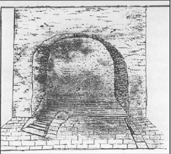
The Holy Well Immersion Bath from a 17th Century Sketch
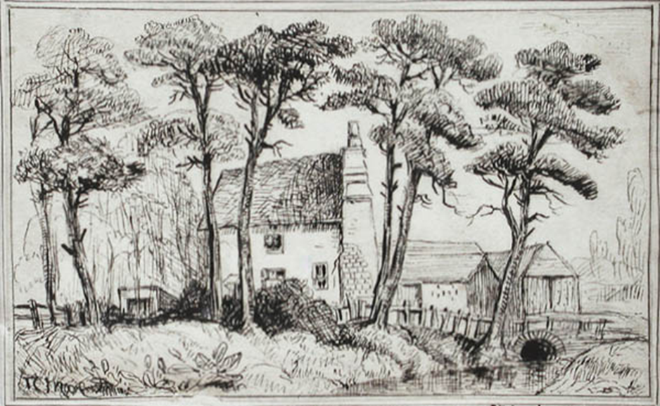
Thomas Moore: ‘Robin Hood’s Well. (18th Century)
The Paul Nix Collection
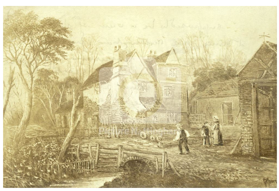
The St Ann’s Well stream drawn by TC Moor, 1850.
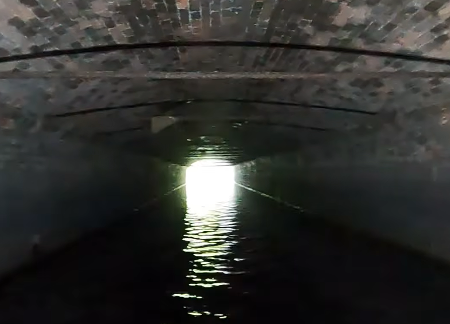
The Portal of the Beck’s Burn as it enters the River Trent.
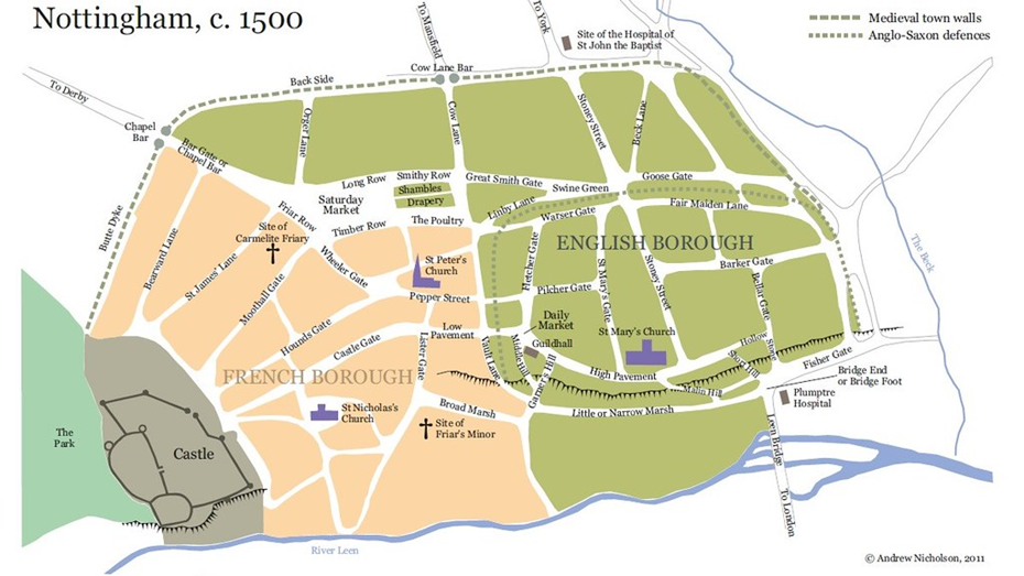
The map of Nottingham shows the Beck Burn entering the River Leen, though today it enters the River Trent. The Leen was rerouted in the 17th and 18th centuries to flow to the west of the city and the Burn was then channeled towards the River Trent via marshlands that were only partly dried out in the 19th Century. Areas to the west of the Beck Burn are still protected from flooding by pumps set above the Broad and Narrow Marsh.
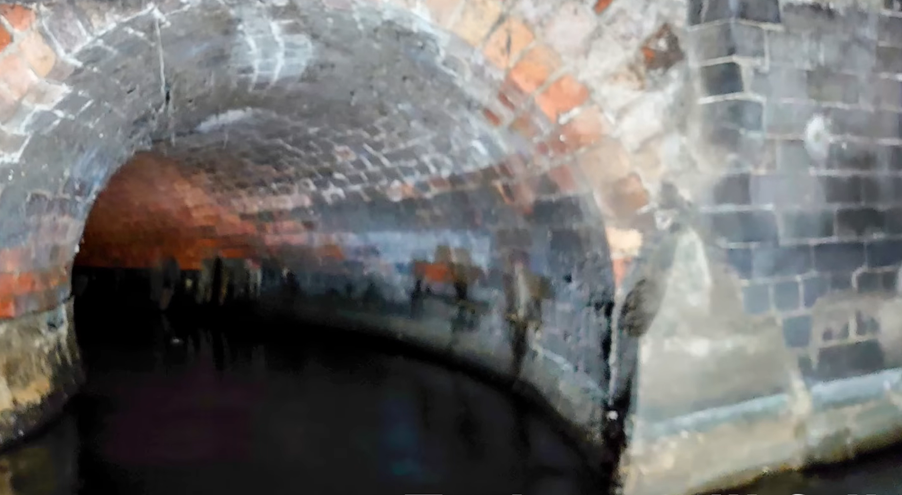
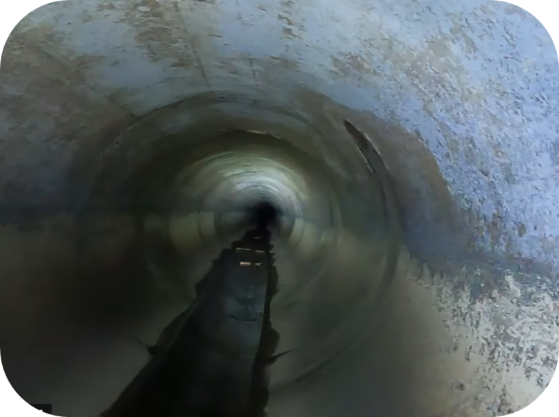
Possible drainage from Broad Marsh/
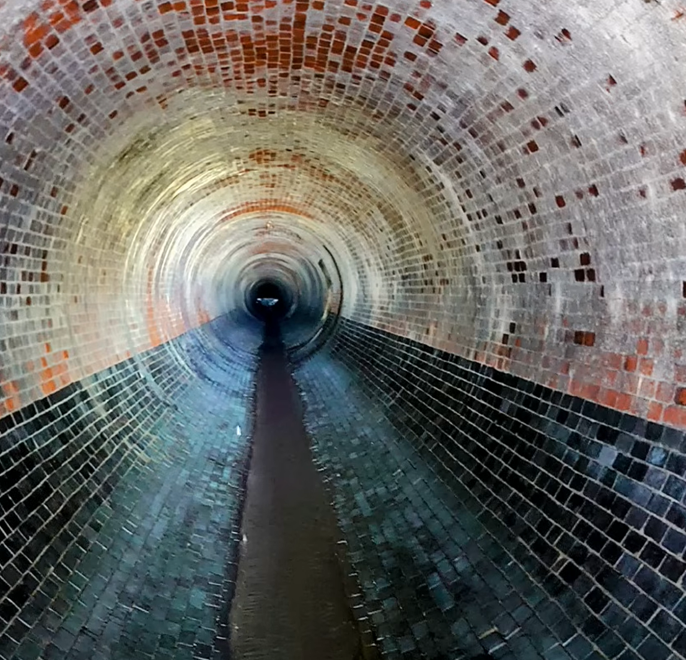
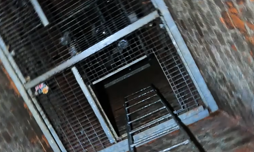
St Marys Rest Gardens.
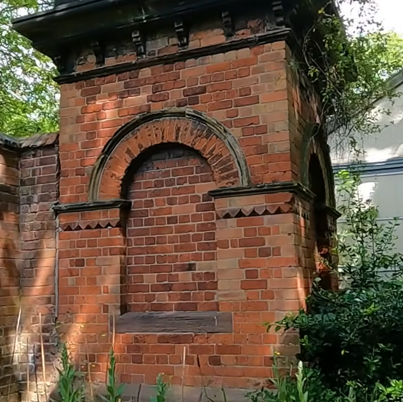
‘.The Beck Valley Storm Water Culvert. This was one of the public works constructed to improve the drainage of a Nottingham still subject to outbreaks of water-borne diseases rife in areas where the sewerage systems were ineffectual. The Beck Stream flowed underground from St Ann’s Well, down the course of St Ann’s Well Road, along Brook Street, and Manvers Street; though it had, from the time it was culverted, been used as a sewer, it was hopelessly inadequate. St Ann’s Well Road was subject to frequent flooding, and the need for a replacement sewer was clear. The Beck Valley Culvert was therefore planned to follow the course of the stream from near the bottom of St Ann’s Well Road, then to bear off to the east under the site of the present-day St Catharine’s church, the adjacent burial ground, and the Bath Street Cricket Ground. It then crossed Bath Street, and went beneath Sneinton market; its outfall to the River Trent is at the end of Trent Lane in Sneinton. The first mention in the minute books of the consequent engineering works was when Mr Barry, of Foster and Barry, contractors for the culvert, attended the Public Parks Committee meeting of November 21 1883, asking to rent about 1,000 square yards of the cricket ground, for the erection of stores for materials needed during the course of the works. It was resolved that this land be let to Foster & Barry for 50 guineas. This work was to provide the recreation ground with a feature which survives to this day, and which puzzles many passers-by. This is the curious little stone tower, which stands close to the boundary wall with the old cemetery. Of handsome architectural brickwork, it was until recent years smothered in ivy. It is believed that the tower was originally an access shaft to the Beck Culvert tunnel during its construction, though it became a ventilation shaft for the culvert, foul air being carried up the shaft, and out through a grille at the top.’ ‘ Anon. nottshistory
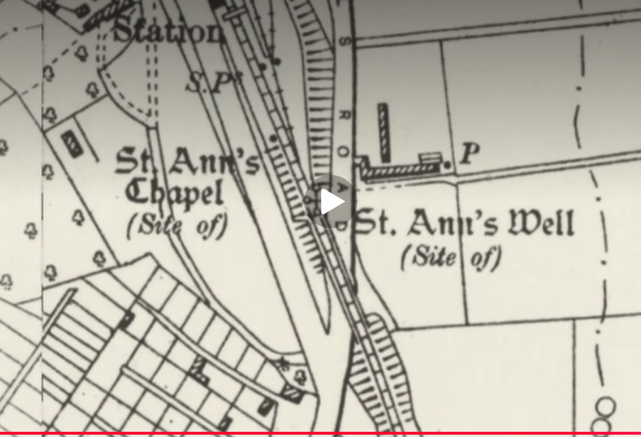
19th Century Ordnance Survey of St Ann’s, Nottingham.
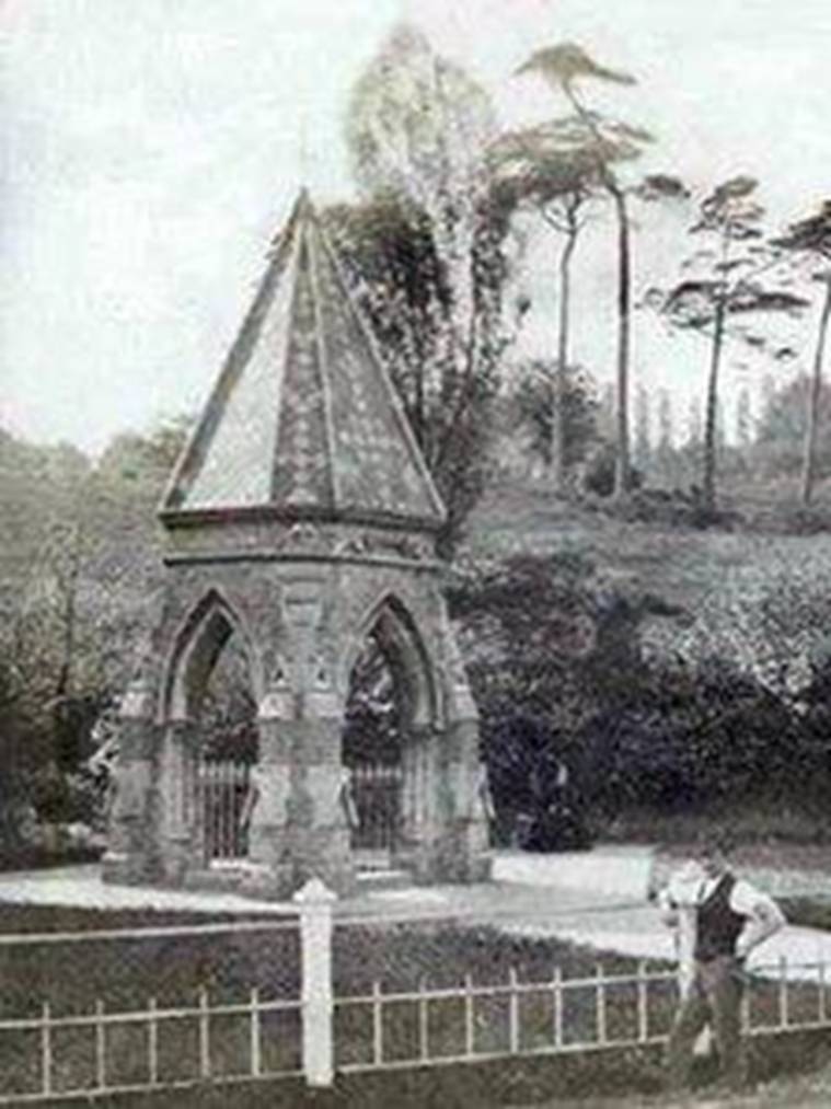
St Ann’s Well: This Victorian structure stood on the well site from 1856 to 1873.
It was recorded in 1301 as The Brodewell and in other historical references it was called the Owswell or Robin Hood’s Well.
The spring was appropriated by monks who built a chapel adjacent to the well and dedicated the site to St Ann, the assessment said. There are 17th Century records of an annual Easter procession to the well made by the Mayor of Nottingham, aldermen and local officials, accompanied by musicians.
The spring gradually took on more of a secular appeal, the assessment said, becoming “a sort of pleasure ground and public house for the amusement of the local population” by the 19th Century.
A Gothic-like spired structure stood on the site from 1856 to 1887, when it was demolished to make way for the Nottingham Suburban Railway which remained in use until 1954.
‘Posted on January 21, 2013 by nottinghamhiddenhistoryteam
by Frank E Earp
IT is hard to imagine now that the area covered by the St Annʼs district of Nottingham was once a part of Sherwood Forest. With a few scattered dwellings, it remained covered in rough pasture and woodland until the mid-1800s.
The most important building was the house occupied by the Woodward, an officer of the Mayor appointed to manage this part of the forest. On ʻhigh daysʼ and holidays, the people of Nottingham flocked in their thousands to this spot and had done so for generations. ʻThither do the Towns-men resort by an ancient custom beyond memoryʼ.
It was not just the civic dignitaries and the common folk of Nottingham who visited the Woodwardʼs house. James I and his court, including Lord Gilbert, Earl of Shrewsbury, stopped to refresh themselves on returning from a hunting trip in the Forest. They did so by drinking the barrels of the Woodward dry. What attracted the good folk of the town in such numbers to such a remote place? It was not the Woodwardʼs ale! The answer is the ancient ʻHoly Wellʼ known officially as ʻSt. Annʼs Wellʼ – called by the people ʻRobin Hoodʼs Wellʼ.
The Well is described in 1797 as “being under an arched stone roof, of rude workmanship”. It was noted as being the second coldest in the country; in fact the water being so cold that it would kill a toad. Bathing in the water was believed to cure rheumatic pains and all manner of illnesses. We must not feel sorry for the Woodward who received a visit from the King. It seems that successive Woodwards exploited the fame of the Well and the house became a money making ʻvictualing houseʼ – a café or pub.
An 18th century description says that it was surrounded by ʻ… fair summer houses, bowers or arbours covered by plashing and interweaving of oak-boughs for shadeʼ. These were equipped with large oak tables and earth banks for seating. Here the public could dine on food from the kitchen or provide their own food to be cooked on the premises. All this was doubtlessly accompanied by copious amounts of ale purchased from the owner. Two large rooms were provided for the dinners in inclement weather. Visits to the well were popular through out the year, with the summer months attracting the most visitors. However, particular attention was made at Christmas, Easter and Whitsuntide.
At a very early date a little museum – probably Nottinghamʼs first — dedicated to Robin Hood, had been set up. This contained items said to belong to the outlaw. These included his cap, a metal helmet, and his bow. An unusualitem was a small ivory tusk said to be Robinʼs tooth. Central to the exhibition was a large wicker chair known as Robin Hoodʼs Chair. Young men were charged for the privilege of sitting in the chair and ʻsalutingʼ their lady friends and thus being recognised as a member of ʻThe Brotherhood of the Chairʼ. The museum and its contents lasted well into the 18th century. However, the chair had received so much attention that it had fallen to pieces and only a small panel was displayed at this time.
An obscure medieval reference, seldom quoted, speaks of a darker practice about the Well: ‘The bodies of unfortunate criminals (who were hung on Gallows Hill, a spot on Mansfield Road by St Andrewʼs church), were taken to St Annʼs and hung in chains from trees about the Well’.
The term Well rather than Spring was used to imply that the ʻspring headʼ had been covered or artificially channelled in the remote past.
With use by grazing animals such as deer, a natural clearing in the surrounding woodland developed around the spring. Such water sources attracted the attention of the earliest settlers. Water is a life-giving necessity and as safe, reliable supply such as a spring would have been considered as a gift from the gods.
We do not know how many centuries it was before this forest spring was covered and modified. Something different or special about the water, perhaps it was the intense
cold, quickly led to the belief that the spring had healing properties. Some form of management of the site and artificial trough or basin to collect run-off is likely to have been in use long before the first Anglo Saxons arrived in Nottingham. The earliest written reference to the Well gives the name as Brodwell, — possibly derived from the Saxon Brod, a coming together or to shoot or spout. This name was still in use as late as 1301. An alternative name occurring in written references is Owswell. It has been suggested that the element Ows is a localised Saxon word for the goddess Eostre. However, it seems more likely that it is derived from the Saxon ʻOstarmanothʼ — Easter Month, April, — perhaps denoting the time when the spring flowed at its strongest. By the time of these early references the well was already coincided as a Christian holy and healing spring and was under the care of a hermit who lived close by in a stone cell or hermitage. For a small charge the sick could take
ʻtrysting placeʼ – meeting place – of the Outlaw. In the ʻGeste of Robin Hoodʼ, the site is described as being ʻone mile under the lyndeʼ (one mile from the town under the forest) and ʻnot more than a heap of stones, fit only for a hermit or friarʼ. This description, along with other elements of the story, fits the Well site. Certainly the people of Nottingham were convinced of a connection between the well and the outlaw and began to refer to it as ʻRobin Hoodʼs Wellʼ. This title probably occurred long before any printed ballads began to circulate in the reign of Henry VII.
Advertisement
Privacy Settings
When the Priory at Lenton seized the Well, it was along with Buxton and Malvern — both also dedicated to St Ann — rated as being one of the three ʻgreat healing wellsʼ of England. It is likely that the seizure was motivated out of acquiring a lucrative source of revenue rather than a religious site. Whatever the motivation, the monkʼs control of the site lasted until the Prioryʼs dissolution in 1536. From this time on St Annʼs Well, as it was now called, was administrated by the Mayor and Corporation of Nottingham. Slowly the site became increasingly secular and the chapel began to fall into ruin.
Between 1543 and 1534 the records of the Corporation show money paid for repairs to ʻSainte Anʼ Chappelʼ. By 1577 records show that the chapel had become ruinous and to have been partly absorbed into the Woodwardʼs House.
Although the annual procession to St Annʼs had become more of a civic event, it ceased with the outbreak of the Civil War in 1642. Because of this increased secularisation of the site, St Annʼs survived the Civil War and Commonwealth. With the Restoration the well once again became popular and by the 18th century.
The Enclosure Act of 1773 saw development of the area. By the early 1800s, the old Woodwardʼs, which had become a public house, become a rowdy out-of-town drinking den.
In 1825 matters had become so serious that the pubʼs licence was revoked and for 30 years it became a tea-room and then a private house. In 1857 the Corporation Engineer, Mr Tarbottom, realised that future development of the area threatened the site and constructed a large ʻgothicʼ style monument over the Well. However, things now become a little confused and there is some dispute as to the Wellʼs precise location.
In 1887 all buildings in the area were demolished to make way for the long anticipated Nottingham Suburban Railway and it was believed that the monument and Well were covered by one of the supports for the Wells Road Viaduct.
The railway and viaduct were demolished in 1957 and new properties built on the land. In 1987 with the demolition of the Gardenersʼ public house, the site of the well was believed to have been discovered in the pubʼs car park. This site was privately excavated by Mr David Greenwood (in 1987) and the results subsequently published in 2007 in the publication ‘Robin of St Ann’s Well Road’.’
Reference Material:
Internet
http://www.nottshistory.org.uk/articles/sneinton/sm54_17-22.htm
ils/poster/ntgm007622/posterid/ntgm007622.html
Briscoe, P., 1881. Old Nottinghamshire. London: Hamilton, Adams & Co.
Greenwood, D., 2007. Robin of St Ann’s Well Road. Nottingham: David Greenwood.
Morrell, R., 1990. Nottinghamshire Holy Well and Springs. Nottingham: APRA
Pres
Morrell, R., 1994. The great spring of the township, in, At the Edge. No 21.